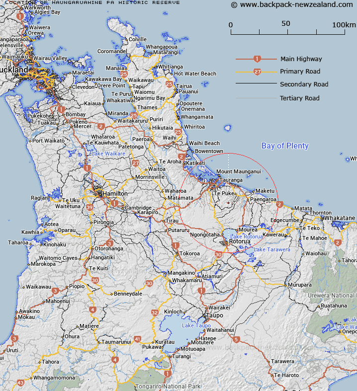
Map showing location of Maungaruahine Pa Historic Reserve


LINZ description: As shown in the Waitaha Deed of Settlement Plan OTS-075-19. Described as 17.3200 hectares, more or less, being Section 51 Block V Maketu Survey District.
Latitude: -37.845
Longitude: 176.263333
Northing: 5806362.1
Easting: 1887152.7
Land District: South Auckland
Feat Type: Historic Reserve


Scroll down to see a more detailed road map and below that a topographical map showing the location of Maungaruahine Pa Historic Reserve. The road map has been supplied by openstreetmap and the topographical map of Maungaruahine Pa Historic Reserve has been supplied by Land Information New Zealand (LINZ).

Yes you can use the top static map for you school/university project or personal website with a link back. Contact me for any commercial use.

Maungaruahine Pa Historic Reserve Map New Zealand


New Zealand places in our database
[ A ] [ B ] [ C ] [ D ] [ E ] [ F ] [ G ] [ H ] [ I ] [ J ] [ K ] [ L ] [ M ] [ N ] [ O ] [ P ] [ Q ] [ R ] [ S ] [ T ] [ U ] [ V ] [ W ] [ X ] [ Y ] [ Z ]


Closest 20 Historic Reserves to Maungaruahine Pa Historic Reserve

Gate Pa Historic Reserve ( 17.91km )   Gerald Crapp Historic Reserve ( 30.46km )   Kauri Point Historic Reserve ( 44.83km )   Gudex Memorial Park Historic Reserve ( 64.07km )   Victoria Battery Historic Reserve ( 64.49km )   Fort Galatea Historic Reserve ( 72.92km )   Paparoa Pa Historic Reserve ( 74.42km )   Matekerepu Historic Reserve ( 78.87km )   Tokitoki Historic Reserve ( 79.25km )   Waiotahi Spit Historic Reserve ( 83.98km )   Waiotahe Spit Historic Reserve ( 83.98km )   Selwyn Park Historic Reserve ( 84.07km )   Kakepuku Mountain Historic Reserve ( 92.26km )   Paterangi Historic Reserve ( 92.55km )   Hine Rae Historic Reserve ( 93.56km )   Smith Historic Reserve ( 96.45km )   Taniwha Pa Historic Reserve ( 98.22km )   Opepe Bush Scenic & Historic Reserve ( 102.49km )   Sailors Grave Historic Reserve ( 105.01km )   Te Wheoro's Redoubt Historic Reserve ( 109.68km )   Rangiriri Pa Historic Reserve ( 110.1km )   Te Puia Block Historic Reserve ( 111.36km )   Te Pare Point Historic Reserve ( 118.13km )   Wigmore Historic Reserve ( 119.09km )   Meremere Pa Site Historic Reserve ( 120.34km )   Whangamarino Redoubt Historic Reserve ( 122.42km )   Puraho Historic Reserve ( 127.67km )   Puketapu Historic Reserve ( 130.05km )   Opito Point Historic Reserve ( 131.27km )   Bald Spur Historic Reserve ( 132.3km )   Pratts Road Historic Reserve ( 136.92km )   Opera Point Historic Reserve ( 137.32km )   Cameron Town Historic Reserve ( 138.08km )   School Of Mines Historic Reserve ( 138.69km )   Te Heru o T?reia Historic Reserve ( 143.4km )   St Johns Redoubt Historic Reserve ( 153.85km )   Stony Batter Historic Reserve ( 154.14km )   Wiri Historic Reserve ( 155.32km )   Waiau Pa Historic Reserve ( 157.61km )   Tiwaewae Memorial Reserve Historic Reserve ( 162.24km )