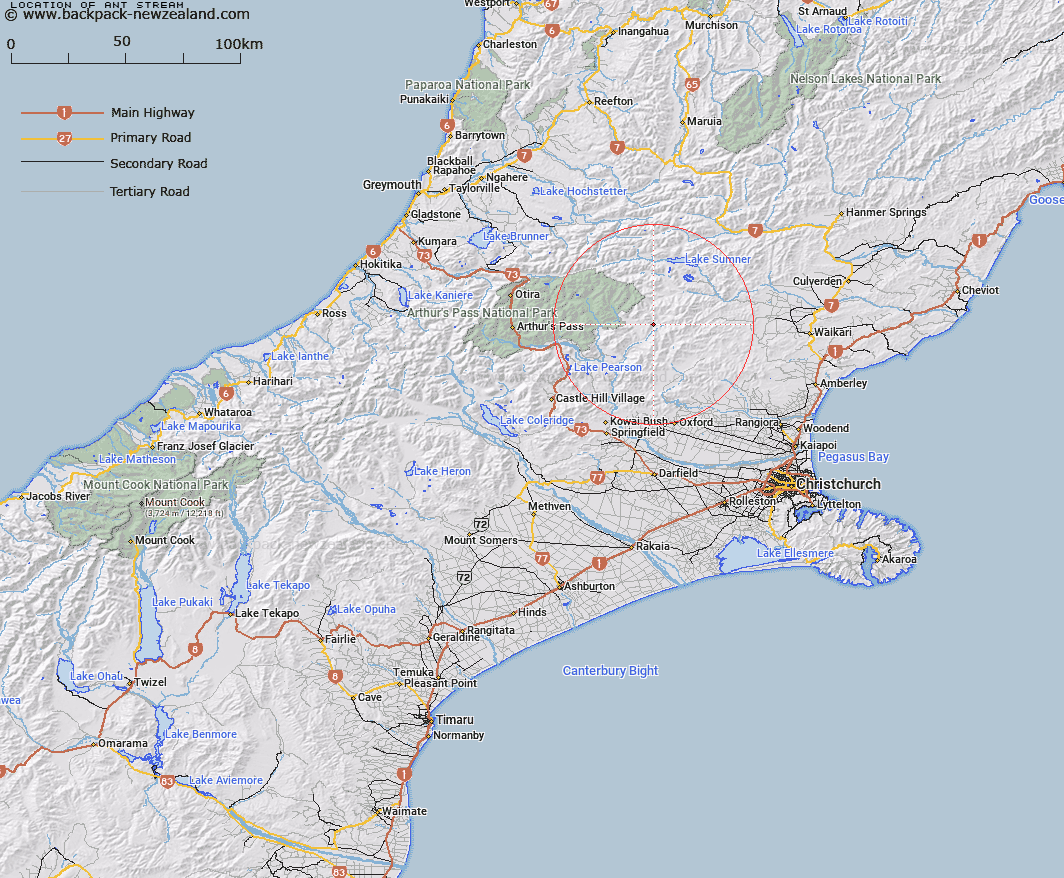
Map showing location of Ant Stream


LINZ description: Tributary of Esk River, rises under Mt Crossley at the Junction of Dampier and the Candlesticks Ranges.
Latitude: -42.936099
Longitude: 172.107731
Northing: 5245895.1
Easting: 1527197.1
Land District: Canterbury
Feat Type: Stream


Scroll down to see a more detailed road map and below that a topographical map showing the location of Ant Stream. The road map has been supplied by openstreetmap and the topographical map of Ant Stream has been supplied by Land Information New Zealand (LINZ).

Yes you can use the top static map for you school/university project or personal website with a link back. Contact me for any commercial use.

Ant Stream Map New Zealand


New Zealand places in our database
[ A ] [ B ] [ C ] [ D ] [ E ] [ F ] [ G ] [ H ] [ I ] [ J ] [ K ] [ L ] [ M ] [ N ] [ O ] [ P ] [ Q ] [ R ] [ S ] [ T ] [ U ] [ V ] [ W ] [ X ] [ Y ] [ Z ]


Closest 20 Streams to Ant Stream

Anna Stream ( 1.75km )   Flora Stream ( 3.31km )   Pig Spur Stream ( 3.51km )   Esk River ( 4.09km )   Fossil Stream ( 4.73km )   Fooks Stream ( 6.05km )   Nigger Stream ( 6.31km )   P?kio Stream ( 6.31km )   Grant Stream ( 6.62km )   Lochinvar Stream ( 6.81km )   Anderson Stream ( 8.07km )   Baldy Stream ( 8.81km )   Camp Stream ( 8.91km )   Laurie Stream ( 9.37km )   Hungerford Stream ( 9.72km )   Bush Gully Stream ( 10.09km )   Lucy Stream ( 10.25km )   Lillburn River ( 10.39km )   Lilburne River ( 10.39km )   Youngman Stream ( 10.77km )   Duncan Stream ( 11.25km )   Whitnow Stream ( 12.22km )   Crossley Stream ( 12.27km )   Brechin Burn ( 12.29km )   Panhandle Stream ( 12.32km )   Candlestick Stream ( 12.36km )   Woollies Stream ( 12.4km )   Deep Stream ( 13.21km )   Den Stream ( 13.6km )   Pember Stream ( 13.78km )   Beckett Stream ( 14.17km )   Cochran Stream ( 14.28km )   North Esk River ( 14.32km )   Waterfall Stream ( 14.43km )   Punanui Stream ( 14.73km )   Boundary Stream ( 14.84km )   Bridge Stream ( 14.91km )   Bull Creek ( 14.96km )   Valley Stream ( 14.96km )   Ensor Stream ( 14.99km )