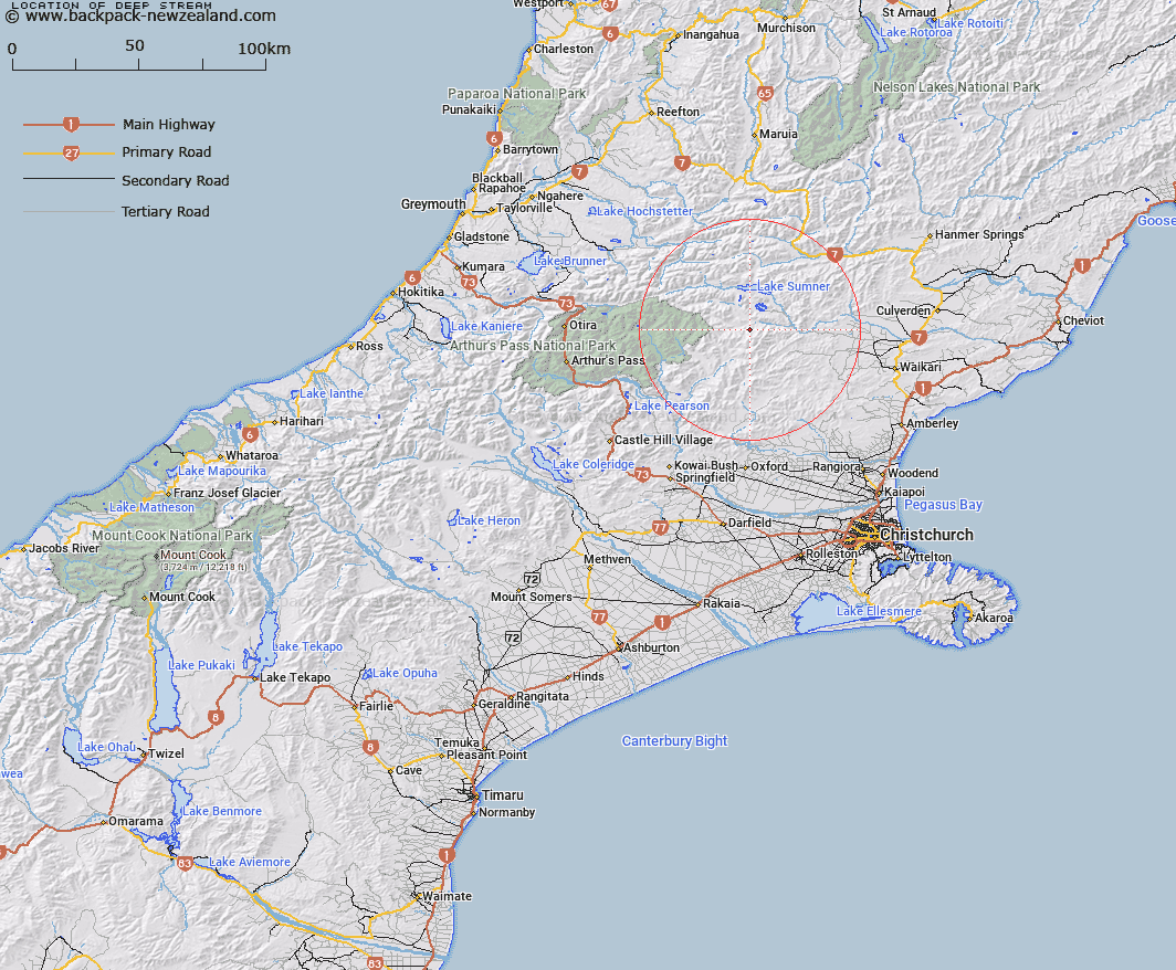
Map showing location of Deep Stream


LINZ description: Stream rising on north slopes of Dampier Range, flows north into North Esk River.
Latitude: -42.839989
Longitude: 172.203106
Northing: 5256646
Easting: 1534878
Land District: Canterbury
Feat Type: Stream


Scroll down to see a more detailed road map and below that a topographical map showing the location of Deep Stream. The road map has been supplied by openstreetmap and the topographical map of Deep Stream has been supplied by Land Information New Zealand (LINZ).

Yes you can use the top static map for you school/university project or personal website with a link back. Contact me for any commercial use.

Deep Stream Map New Zealand


New Zealand places in our database
[ A ] [ B ] [ C ] [ D ] [ E ] [ F ] [ G ] [ H ] [ I ] [ J ] [ K ] [ L ] [ M ] [ N ] [ O ] [ P ] [ Q ] [ R ] [ S ] [ T ] [ U ] [ V ] [ W ] [ X ] [ Y ] [ Z ]


Closest 20 Streams to Deep Stream

Deep Stream ( 0km )   Woollies Stream ( 1.41km )   Valley Stream ( 2.42km )   Zig Zag Stream ( 3.55km )   Zigzag Creek ( 3.6km )   Bush Gully Stream ( 3.96km )   Bridge Stream ( 4.59km )   Homestead Stream ( 4.74km )   Anderson Stream ( 5.28km )   Lucy Stream ( 5.75km )   Flax Stream ( 6.96km )   Clay Spur Stream ( 7.81km )   Crossley Stream ( 7.89km )   Woolshed Stream ( 7.93km )   Bull Stream ( 7.97km )   Bull Creek ( 8.11km )   Waterfall Stream ( 8.3km )   Trumper Stream ( 8.49km )   Fossil Stream ( 8.5km )   Bush Stream ( 8.82km )   Kennedy Stream ( 8.86km )   Sisters Stream ( 9.45km )   North Esk River ( 9.5km )   Seaward River ( 9.61km )   Mason Stream ( 9.98km )   Lagoon Stream ( 10.42km )   Hut Branch ( 10.59km )   Grant Stream ( 10.64km )   Dust Stream ( 10.74km )   Rough Stream ( 10.83km )   Horseshoe Stream ( 11.13km )   Fooks Stream ( 11.19km )   Whitnow Stream ( 11.25km )   Anna Stream ( 11.47km )   Stony Stream ( 11.89km )   Virginia Stream ( 12.34km )   Woodchopper Stream ( 12.35km )   Double End Stream ( 12.67km )   Candlestick Stream ( 12.84km )   Ant Stream ( 13.21km )