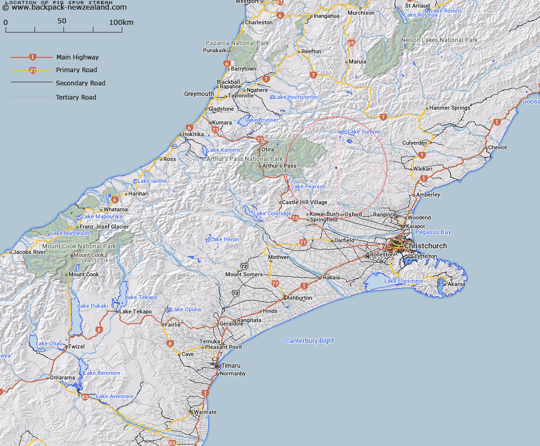
Map showing location of Pig Spur Stream


LINZ description: Left bank tributary of Esk River rising North of Trig. B (Geodetic Code A9E0), flowing northwards and joining Esk River 2km upstream of Ant Stream. Blocks VII and XI, Esk Survey District.
Latitude: -42.95671
Longitude: 172.140374
Northing: 5243634
Easting: 1529883.9
Land District: Canterbury
Feat Type: Stream


Scroll down to see a more detailed road map and below that a topographical map showing the location of Pig Spur Stream. The road map has been supplied by openstreetmap and the topographical map of Pig Spur Stream has been supplied by Land Information New Zealand (LINZ).

Yes you can use the top static map for you school/university project or personal website with a link back. Contact me for any commercial use.

Pig Spur Stream Map New Zealand


New Zealand places in our database
[ A ] [ B ] [ C ] [ D ] [ E ] [ F ] [ G ] [ H ] [ I ] [ J ] [ K ] [ L ] [ M ] [ N ] [ O ] [ P ] [ Q ] [ R ] [ S ] [ T ] [ U ] [ V ] [ W ] [ X ] [ Y ] [ Z ]


Closest 20 Streams to Pig Spur Stream

Ant Stream ( 3.51km )   Anna Stream ( 3.94km )   Esk River ( 3.97km )   Grant Stream ( 4.63km )   Laurie Stream ( 5.9km )   Fossil Stream ( 6.29km )   Flora Stream ( 6.42km )   Youngman Stream ( 7.66km )   Lillburn River ( 7.74km )   Lilburne River ( 7.74km )   Duncan Stream ( 7.75km )   Anderson Stream ( 8.69km )   Panhandle Stream ( 9.15km )   Hungerford Stream ( 9.15km )   Nigger Stream ( 9.25km )   P?kio Stream ( 9.25km )   Fooks Stream ( 9.3km )   Lochinvar Stream ( 9.66km )   Baldy Stream ( 9.85km )   Whitnow Stream ( 9.91km )   Den Stream ( 10.28km )   Camp Stream ( 10.8km )   Punanui Stream ( 11.22km )   Ensor Stream ( 11.52km )   Bush Gully Stream ( 11.6km )   Pember Stream ( 11.8km )   Okuku River ( 12.23km )   Brechin Burn ( 12.25km )   Lucy Stream ( 12.35km )   Whistling Creek ( 12.76km )   Fraser Stream ( 12.8km )   Waterfall Stream ( 13.05km )   Stockyard Stream ( 13.1km )   Long Spur Stream ( 13.21km )   Woollies Stream ( 13.45km )   Retreat Creek ( 13.7km )   Boundary Stream ( 13.72km )   Pancake Stream ( 13.81km )   Deep Stream ( 13.95km )   Hut Branch ( 14.35km )