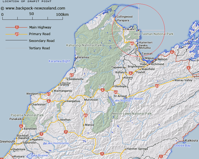
Map showing location of Sawpit Point


LINZ description: Point near entrance to Awaroa Inlet, with Trig. K (Geodetic Code AMQW) situated on it, 750m North-west of Mount Rollinson. Abel Tasman National Park. Block VII Totaranui Survey District.
Latitude: -40.861471
Longitude: 173.020161
Northing: 5476620.6
Easting: 1601699.1
Land District: Nelson
Feat Type: Point


Scroll down to see a more detailed road map and below that a topographical map showing the location of Sawpit Point. The road map has been supplied by openstreetmap and the topographical map of Sawpit Point has been supplied by Land Information New Zealand (LINZ).

Yes you can use the top static map for you school/university project or personal website with a link back. Contact me for any commercial use.

Sawpit Point Map New Zealand


New Zealand places in our database
[ A ] [ B ] [ C ] [ D ] [ E ] [ F ] [ G ] [ H ] [ I ] [ J ] [ K ] [ L ] [ M ] [ N ] [ O ] [ P ] [ Q ] [ R ] [ S ] [ T ] [ U ] [ V ] [ W ] [ X ] [ Y ] [ Z ]


Closest 20 Points to Sawpit Point

Cave Point ( 0.69km )   Ratakura Point ( 2.36km )   Awaroa Head ( 2.45km )   Abel Head ( 3.23km )   Skinner Point ( 3.45km )   Reef Point ( 4.06km )   Boulder Point ( 4.13km )   Arch Point ( 5.07km )   Foul Point ( 6.1km )   South Head ( 7.36km )   Burial Point ( 8.59km )   Separation Point / Te Matau ( 8.97km )   Separation Point ( 8.97km )   Uarau Point ( 9.03km )   Uarou Point ( 9.03km )   North Head ( 9.15km )   Taup? Point ( 9.77km )   Pitt Head ( 10.66km )   Abel Tasman Point ( 10.75km )   Adolphe Point ( 11.81km )   Tekaritu Point ( 12.05km )   Te Karetu Point ( 12.05km )   Yellow Point ( 12.7km )   Jules Point ( 13.39km )   Sandy Point ( 13.58km )   Guilbert Point ( 14.27km )   Tokongawha Point ( 17.35km )   Rangihaeata Head ( 20.23km )   Anawera Point ( 21.04km )   Anarewa Point ( 21.04km )   Tukurua Point ( 30.65km )   Bush End Point ( 34.21km )   Brandy Point ( 35.64km )   Taimatea Point ( 39.45km )   Tomatea Point ( 40.71km )   Stockyard Point ( 40.83km )   Abel Head ( 44.03km )   Puponga Point ( 44.03km )   Matahua ( 44.39km )   Grossi Point ( 44.89km )