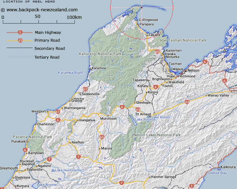
Map showing location of Abel Head


LINZ description: Point, facing Golden Bay at Port Puponga. Block III Onetaua Survey District
Latitude: -40.529036
Longitude: 172.736504
Northing: 5513488.9
Easting: 1577682.6
Land District: Nelson
Feat Type: Point


Scroll down to see a more detailed road map and below that a topographical map showing the location of Abel Head. The road map has been supplied by openstreetmap and the topographical map of Abel Head has been supplied by Land Information New Zealand (LINZ).

Yes you can use the top static map for you school/university project or personal website with a link back. Contact me for any commercial use.

Abel Head Map New Zealand


New Zealand places in our database
[ A ] [ B ] [ C ] [ D ] [ E ] [ F ] [ G ] [ H ] [ I ] [ J ] [ K ] [ L ] [ M ] [ N ] [ O ] [ P ] [ Q ] [ R ] [ S ] [ T ] [ U ] [ V ] [ W ] [ X ] [ Y ] [ Z ]


Closest 20 Points to Abel Head

Fossil Point ( 2.65km )   Pillar Point ( 3.41km )   Cape Farewell ( 5.09km )   Pilch Point ( 8.03km )   Tomatea Point ( 8.3km )   Stockyard Point ( 9.65km )   Pecks Point ( 10.25km )   M?ori Point ( 10.95km )   Taimatea Point ( 11.03km )   Oyster Point ( 12.51km )   Kaihoka Point ( 13.33km )   Moki Point ( 15.03km )   Bar Point ( 16.45km )   South Head Cone ( 18.04km )   Melbourne Point ( 18.39km )   Tukurua Point ( 22.66km )   Sharks Head ( 22.79km )   Bush End Point ( 23.98km )   Brandy Point ( 29.99km )   Rangihaeata Head ( 30.53km )   Abel Tasman Point ( 33.94km )   Taup? Point ( 34.26km )   Uarau Point ( 35.07km )   Uarou Point ( 35.07km )   Separation Point ( 35.79km )   Separation Point / Te Matau ( 35.79km )   Burial Point ( 35.95km )   Skinner Point ( 40.77km )   Ratakura Point ( 41.84km )   Cave Point ( 43.66km )   Sawpit Point ( 44.03km )   Awaroa Head ( 44.38km )   Abel Head ( 45.46km )   Boulder Point ( 47.49km )   Reef Point ( 47.87km )   Arch Point ( 49.1km )   Foul Point ( 50.11km )   South Head ( 51.31km )   Kahurangi Point ( 51.67km )   North Head ( 53.04km )