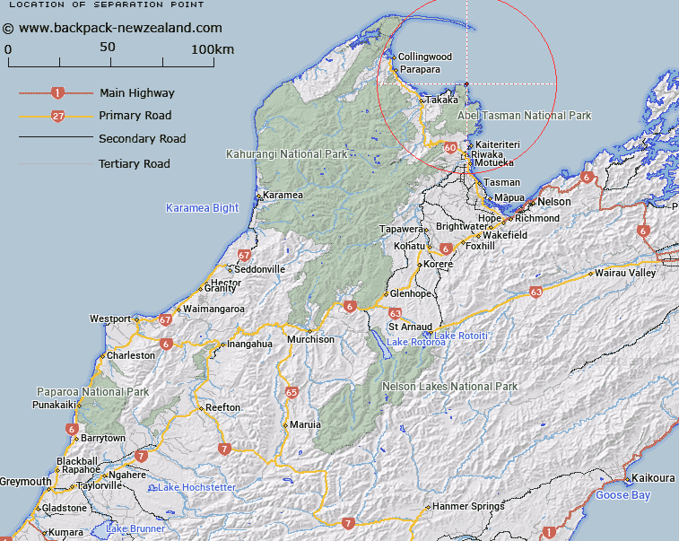
Map showing location of Separation Point
LINZ description: A coastal point between Whariwharangi Bay and Mutton Cove extending into Golden Bay / Mohua approximately 18 km northeast of Takaka. Feature shown on: NZMS260 N25; Infomap 346-02 Te Wai Pounamu Edition 1 1995; NZTopo50-BN25 998854
Latitude: -40.782583
Longitude: 172.997778
Northing: 5485377.8
Easting: 1599812.5
Land District: Nelson
Feat Type: Point
Latitude: -40.782583
Longitude: 172.997778
Northing: 5485377.8
Easting: 1599812.5
Land District: Nelson
Feat Type: Point

Scroll down to see a more detailed road map and below that a topographical map showing the location of Separation Point. The road map has been supplied by openstreetmap and the topographical map of Separation Point has been supplied by Land Information New Zealand (LINZ).
Yes you can use the top static map for you school/university project or personal website with a link back. Contact me for any commercial use.
[ A ] [ B ] [ C ] [ D ] [ E ] [ F ] [ G ] [ H ] [ I ] [ J ] [ K ] [ L ] [ M ] [ N ] [ O ] [ P ] [ Q ] [ R ] [ S ] [ T ] [ U ] [ V ] [ W ] [ X ] [ Y ] [ Z ]