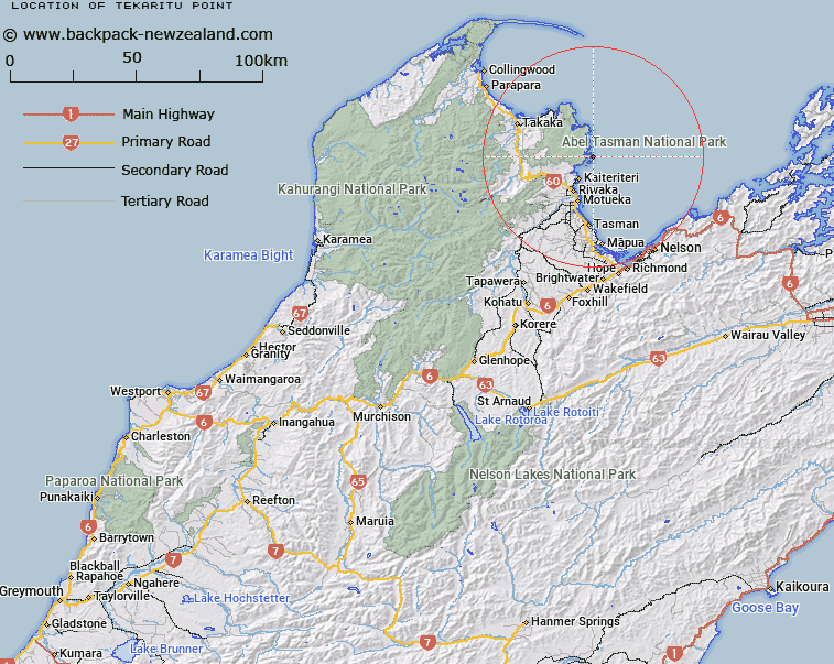
Map showing location of Tekaritu Point


LINZ description: A headland at the north end of Astrolabe Roadstead.
Latitude: -40.964335
Longitude: 173.065362
Northing: 5465200
Easting: 1605500
Land District: Nelson
Feat Type: Point


Scroll down to see a more detailed road map and below that a topographical map showing the location of Tekaritu Point. The road map has been supplied by openstreetmap and the topographical map of Tekaritu Point has been supplied by Land Information New Zealand (LINZ).

Yes you can use the top static map for you school/university project or personal website with a link back. Contact me for any commercial use.

Tekaritu Point Map New Zealand


New Zealand places in our database
[ A ] [ B ] [ C ] [ D ] [ E ] [ F ] [ G ] [ H ] [ I ] [ J ] [ K ] [ L ] [ M ] [ N ] [ O ] [ P ] [ Q ] [ R ] [ S ] [ T ] [ U ] [ V ] [ W ] [ X ] [ Y ] [ Z ]


Closest 20 Points to Tekaritu Point

Adolphe Point ( 0.43km )   Jules Point ( 1.35km )   Pitt Head ( 1.42km )   Yellow Point ( 1.8km )   Sandy Point ( 2.1km )   North Head ( 3km )   Guilbert Point ( 3.75km )   South Head ( 4.81km )   Foul Point ( 6.54km )   Tokongawha Point ( 6.97km )   Arch Point ( 7.33km )   Reef Point ( 8.99km )   Boulder Point ( 9.86km )   Anawera Point ( 10.38km )   Anarewa Point ( 10.38km )   Abel Head ( 11.94km )   Sawpit Point ( 12.05km )   Cave Point ( 12.57km )   Awaroa Head ( 12.62km )   Ratakura Point ( 14.4km )   Skinner Point ( 15.49km )   Burial Point ( 19.84km )   Uarau Point ( 20.74km )   Uarou Point ( 20.74km )   Separation Point / Te Matau ( 20.99km )   Separation Point ( 20.99km )   Taup? Point ( 21.6km )   Abel Tasman Point ( 21.91km )   Rangihaeata Head ( 29.23km )   Matahua ( 32.7km )   Grossi Point ( 33.08km )   M?heipuku Point ( 35.17km )   Ataata Point ( 35.47km )   Platform Point ( 35.54km )   Puket? Point ( 36.46km )   Wave Point ( 37.48km )   Lagoon Point ( 37.87km )   Martin Point ( 39.96km )   Tukurua Point ( 40.26km )   Whangamoa ( 40.81km )