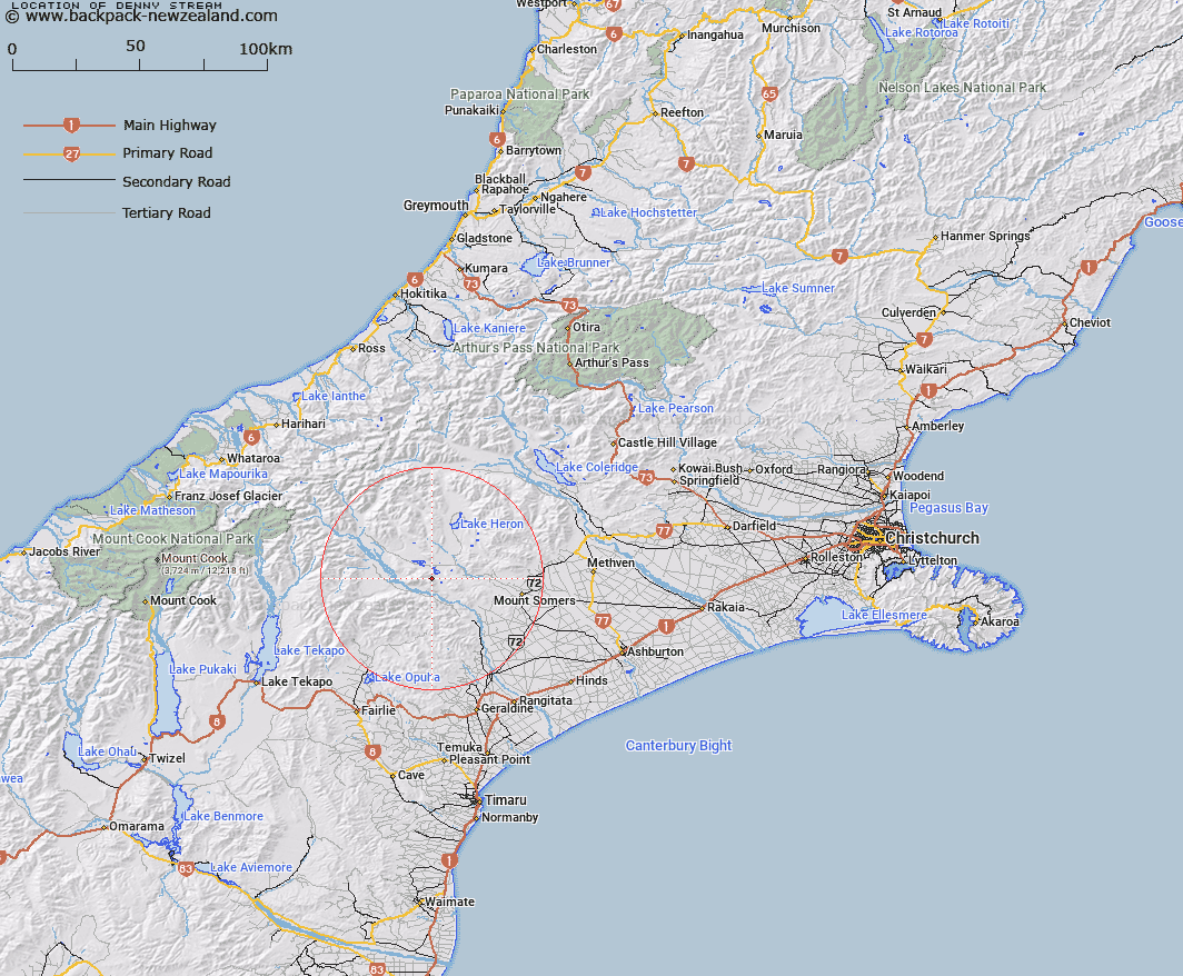
Map showing location of Denny Stream


LINZ description: Stream rising on the eastern slopes of Mount Harper [Trig. O (Geodetic Code ANEL), flowing eastward into Lake Denny. Blocks VI, X, and XI, Tripp Survey District
Latitude: -43.656306
Longitude: 171.089014
Northing: 5164525
Easting: 1445905.4
Land District: Canterbury
Feat Type: Stream


Scroll down to see a more detailed road map and below that a topographical map showing the location of Denny Stream. The road map has been supplied by openstreetmap and the topographical map of Denny Stream has been supplied by Land Information New Zealand (LINZ).

Yes you can use the top static map for you school/university project or personal website with a link back. Contact me for any commercial use.

Denny Stream Map New Zealand


New Zealand places in our database
[ A ] [ B ] [ C ] [ D ] [ E ] [ F ] [ G ] [ H ] [ I ] [ J ] [ K ] [ L ] [ M ] [ N ] [ O ] [ P ] [ Q ] [ R ] [ S ] [ T ] [ U ] [ V ] [ W ] [ X ] [ Y ] [ Z ]


Closest 20 Streams to Denny Stream

Pudding Valley Creek ( 3.42km )   Emma Stream ( 4.28km )   Balmacaan Stream ( 4.53km )   Moorhouse Stream ( 6.43km )   Matagouri Stream ( 7.83km )   Lambies Stream ( 8.1km )   Lodge Stream ( 8.26km )   Whisky Stream ( 8.65km )   Paddle Hill Creek ( 8.65km )   Powerhouse Stream ( 9.02km )   Sandrey Stream ( 9.57km )   Potato Stream ( 9.75km )   Chaffey Stream ( 9.95km )   Waterfall Stream ( 10.26km )   Coal Creek ( 10.69km )   Soup Stream ( 10.89km )   Rawtor Creek ( 11.04km )   Kenneth Creek ( 11.09km )   Quartz Creek ( 11.14km )   Haast Stream ( 11.46km )   Middle Stream ( 11.5km )   Nabob Stream ( 12km )   Craddock Stream ( 12.22km )   Cradock Stream ( 12.22km )   Blue Duck Stream ( 12.66km )   Little Hinds Stream ( 13.15km )   Gentleman Smith Stream ( 13.44km )   Tui Stream ( 13.57km )   Markhams Stream ( 13.64km )   Taffy Creek ( 13.75km )   Johnstone Stream ( 13.81km )   Harding Stream ( 13.89km )   Jacobs Stream ( 14.03km )   Hinds River South Branch ( 14.51km )   Emily Stream ( 14.55km )   Blondin Stream ( 15.16km )   Sparrow Hawk Stream ( 15.21km )   Stour River ( 15.79km )   Boundary Stream ( 15.93km )   Hewson River ( 15.93km )