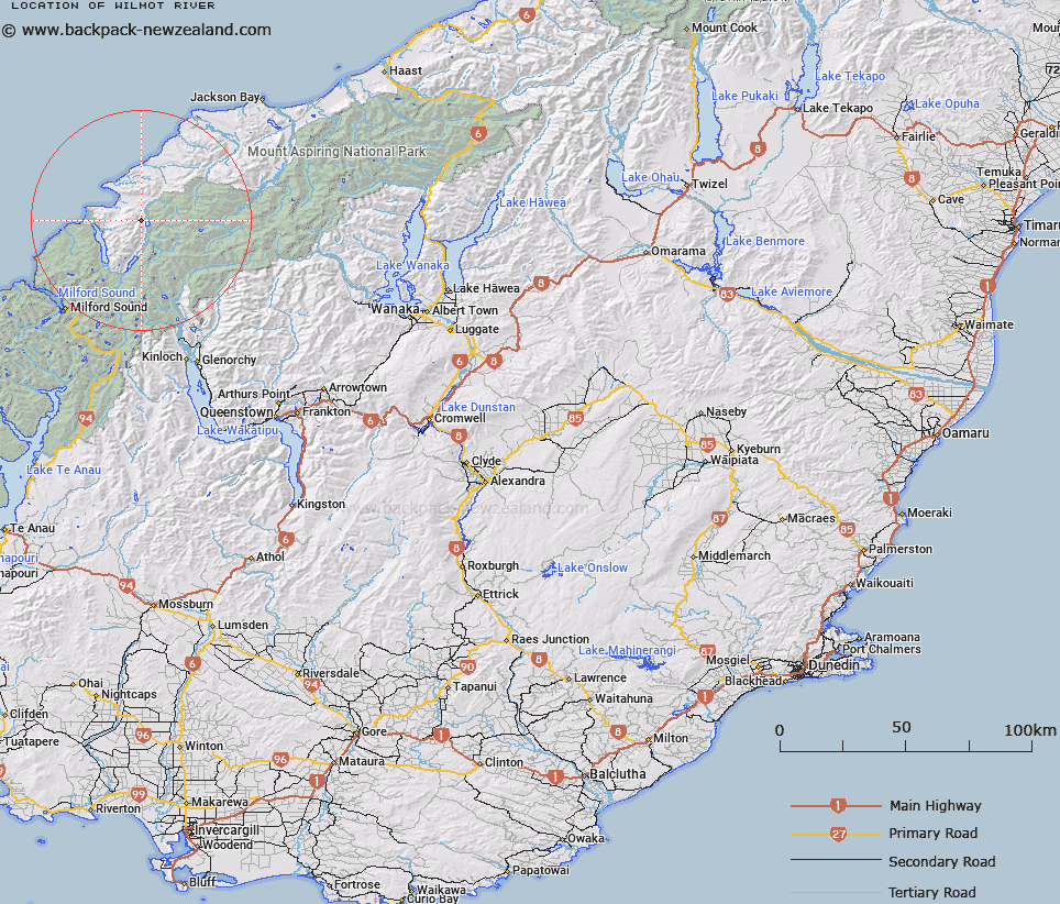
Map showing location of Wilmot River


LINZ description: Rises on the highest part of Skippers Range and flows northerly along its eastern flank into the northern end of Lake Wilmot. It has an overflow channel to Pyke River. Humboldtside Survey District.
Latitude: -44.377916
Longitude: 168.192402
Northing: 5074900
Easting: 1217000
Land District: Otago
Feat Type: Stream


Scroll down to see a more detailed road map and below that a topographical map showing the location of Wilmot River. The road map has been supplied by openstreetmap and the topographical map of Wilmot River has been supplied by Land Information New Zealand (LINZ).

Yes you can use the top static map for you school/university project or personal website with a link back. Contact me for any commercial use.

Wilmot River Map New Zealand


New Zealand places in our database
[ A ] [ B ] [ C ] [ D ] [ E ] [ F ] [ G ] [ H ] [ I ] [ J ] [ K ] [ L ] [ M ] [ N ] [ O ] [ P ] [ Q ] [ R ] [ S ] [ T ] [ U ] [ V ] [ W ] [ X ] [ Y ] [ Z ]


Closest 20 Streams to Wilmot River

Larnachs Creek ( 4.42km )   Barrier River ( 5.73km )   McKenzie Creek ( 5.97km )   Diorite Stream ( 6.21km )   Red Stream ( 7.24km )   Southern Cross Creek ( 8.09km )   Peanut Stream ( 8.24km )   Saddle Stream ( 8.62km )   Dry Awarua River ( 8.69km )   Barrier River North Branch ( 8.94km )   Barrier River South Branch ( 9.09km )   Steep Creek ( 9.32km )   Kea Creek ( 9.54km )   Paulin Creek ( 9.77km )   Awarua River ( 9.97km )   Powell Creek ( 10.01km )   Rata Creek ( 10.1km )   Hokuri Creek ( 10.28km )   Silver Stream ( 10.52km )   Chrome Creek ( 10.59km )   Pyke River ( 10.65km )   Crescent Creek ( 10.68km )   Durwards Creek ( 11.63km )   Trinity Stream ( 11.95km )   Simonin Stream ( 12.18km )   Cloud Creek ( 12.49km )   Red Pyke River ( 12.78km )   Sealy Stream ( 13.21km )   Alabaster Creek ( 13.32km )   Jerusalem Creek ( 13.38km )   McKenzie Creek ( 13.55km )   Forgotten River ( 13.73km )   Peridot Stream ( 13.99km )   Blockade Stream ( 14.07km )   Limbo Stream ( 14.44km )   Milner Ice Stream ( 14.47km )   Olivine River ( 14.75km )   Saddle Creek ( 15.13km )   Kawhaka Creek ( 15.44km )   Barrington Creek ( 15.89km )