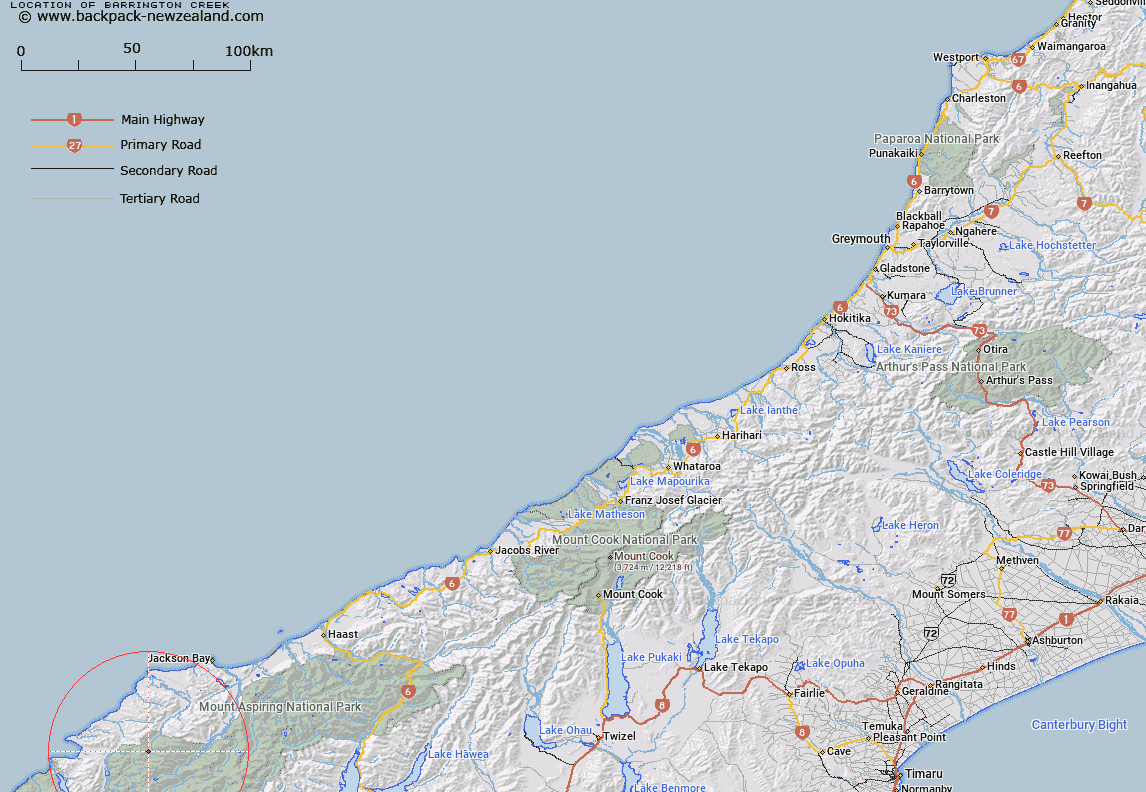
Map showing location of Barrington Creek


LINZ description: A western tributary of Cascade River rising under Red Hills Range.
Latitude: -44.308808
Longitude: 168.367262
Northing: 5083381.2
Easting: 1230496.2
Land District: Westland
Feat Type: Stream


Scroll down to see a more detailed road map and below that a topographical map showing the location of Barrington Creek. The road map has been supplied by openstreetmap and the topographical map of Barrington Creek has been supplied by Land Information New Zealand (LINZ).

Yes you can use the top static map for you school/university project or personal website with a link back. Contact me for any commercial use.

Barrington Creek Map New Zealand


New Zealand places in our database
[ A ] [ B ] [ C ] [ D ] [ E ] [ F ] [ G ] [ H ] [ I ] [ J ] [ K ] [ L ] [ M ] [ N ] [ O ] [ P ] [ Q ] [ R ] [ S ] [ T ] [ U ] [ V ] [ W ] [ X ] [ Y ] [ Z ]


Closest 20 Streams to Barrington Creek

Peridot Stream ( 3.09km )   Malcolm Creek ( 3.9km )   Red Pyke River ( 4.2km )   Holland Creek ( 4.26km )   Simonin Stream ( 4.48km )   Limbo Stream ( 4.57km )   Arcade Creek ( 4.64km )   Granite Creek ( 4.68km )   Retreat Creek ( 4.89km )   Captains Creek ( 5.02km )   Sealy Stream ( 5.99km )   Trinity Stream ( 6.72km )   Rata Creek ( 6.86km )   Kea Creek ( 7.33km )   Steep Creek ( 7.46km )   Chrome Creek ( 8.19km )   Crescent Creek ( 8.26km )   Durwards Creek ( 8.47km )   Halfway Creek ( 8.47km )   Peanut Stream ( 8.57km )   Falls Creek ( 8.7km )   Ridge Creek ( 9.05km )   Low Creek ( 9.07km )   Duncan River ( 9.22km )   Saddle Creek ( 9.38km )   Kawhaka Creek ( 9.39km )   Tornado Creek ( 9.68km )   Ten Hour Gorge Creek ( 9.76km )   Collins Creek ( 9.88km )   McTavish Creek ( 9.89km )   Southern Cross Creek ( 10.02km )   McKenzie Creek ( 10.06km )   Pass Creek ( 10.17km )   Topsey Creek ( 10.21km )   Red Stream ( 10.47km )   Williamson River ( 10.57km )   Saddle Stream ( 10.85km )   Paulin Creek ( 11km )   Barrier River North Branch ( 11.27km )   Silver Stream ( 11.51km )