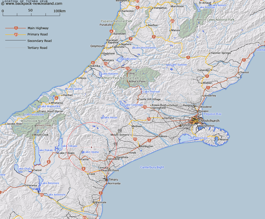
Map showing location of Totara Spur


LINZ description: Spur off the Four Peaks Range
Latitude: -43.916374
Longitude: 171.007702
Northing: 5135486
Easting: 1440043.8
Land District: Canterbury
Feat Type: Ridge


Scroll down to see a more detailed road map and below that a topographical map showing the location of Totara Spur. The road map has been supplied by openstreetmap and the topographical map of Totara Spur has been supplied by Land Information New Zealand (LINZ).

Yes you can use the top static map for you school/university project or personal website with a link back. Contact me for any commercial use.

Totara Spur Map New Zealand


New Zealand places in our database
[ A ] [ B ] [ C ] [ D ] [ E ] [ F ] [ G ] [ H ] [ I ] [ J ] [ K ] [ L ] [ M ] [ N ] [ O ] [ P ] [ Q ] [ R ] [ S ] [ T ] [ U ] [ V ] [ W ] [ X ] [ Y ] [ Z ]


Closest 20 Ridges to Totara Spur

Devils Lookout ( 3.68km )   Crooked Spur ( 7.52km )   McLeods Spur ( 8.86km )   Coxfoot Spur ( 9.26km )   Hat Spur ( 9.8km )   Pickets Spur ( 12.04km )   Coopers Spur ( 14.18km )   Blacksmith Spur ( 16.03km )   Long Spur ( 16.09km )   Walkers Spur ( 16.86km )   Mule Spur ( 17.29km )   Horse Spur ( 17.45km )   Deer Spur ( 18.62km )   Tongue Spur ( 27.61km )   Angel Spur ( 27.91km )   Jimmys Spur ( 30.17km )   Crooked Spur ( 35.94km )   Ranger Spur ( 36.07km )   The Brothers ( 36.13km )   Razor Back ( 44.51km )   Alma Spur ( 45.88km )   Big Rough ( 46.58km )   Rocky Ridge ( 47.26km )   Little Rough ( 47.91km )   Ricki Spur ( 48.76km )   Big Spur ( 49.72km )   Centre Spur ( 51.85km )   Little Spur ( 52.11km )   Joseph Ridge ( 53.13km )   Kea Spur ( 53.39km )   Murphy Spur ( 57.15km )   Two Legged Spur ( 58.07km )   Botanical Spur ( 68.84km )   John Pascoe Ridge ( 69.81km )   Eves Rib ( 69.88km )   Devils Backbone ( 72.9km )   Golden Spur ( 73.84km )   De la Beche Ridge ( 73.99km )   Haast Ridge ( 74.68km )   Linden Ridge ( 75.45km )