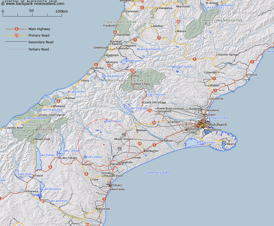
Map showing location of Blacksmith Spur


LINZ description: Spur to north of Mount Peel
Latitude: -43.813256
Longitude: 171.14736
Northing: 5147200
Easting: 1451000
Land District: Canterbury
Feat Type: Ridge


Scroll down to see a more detailed road map and below that a topographical map showing the location of Blacksmith Spur. The road map has been supplied by openstreetmap and the topographical map of Blacksmith Spur has been supplied by Land Information New Zealand (LINZ).

Yes you can use the top static map for you school/university project or personal website with a link back. Contact me for any commercial use.

Blacksmith Spur Map New Zealand


New Zealand places in our database
[ A ] [ B ] [ C ] [ D ] [ E ] [ F ] [ G ] [ H ] [ I ] [ J ] [ K ] [ L ] [ M ] [ N ] [ O ] [ P ] [ Q ] [ R ] [ S ] [ T ] [ U ] [ V ] [ W ] [ X ] [ Y ] [ Z ]


Closest 20 Ridges to Blacksmith Spur

Mule Spur ( 3.38km )   Long Spur ( 3.54km )   McLeods Spur ( 8.26km )   Coopers Spur ( 8.26km )   Hat Spur ( 8.28km )   Pickets Spur ( 8.51km )   Horse Spur ( 9.01km )   Deer Spur ( 10.58km )   Jimmys Spur ( 14.41km )   Totara Spur ( 16.03km )   Devils Lookout ( 17.21km )   Crooked Spur ( 19.74km )   The Brothers ( 20.37km )   Coxfoot Spur ( 20.84km )   Walkers Spur ( 23.01km )   Angel Spur ( 29.36km )   Tongue Spur ( 29.58km )   Ricki Spur ( 34.72km )   Crooked Spur ( 35.67km )   Centre Spur ( 35.86km )   Ranger Spur ( 37.39km )   Alma Spur ( 43.59km )   Rocky Ridge ( 44.21km )   Kea Spur ( 47.87km )   Big Spur ( 48.08km )   Razor Back ( 48.77km )   Little Spur ( 50.21km )   Big Rough ( 53.09km )   Little Rough ( 54.41km )   Murphy Spur ( 54.5km )   Golden Spur ( 60.79km )   Joseph Ridge ( 62.82km )   John Pascoe Ridge ( 64.05km )   Eves Rib ( 65.12km )   Long Spur ( 67.72km )   Devils Backbone ( 68.71km )   Mazda Spur ( 69.82km )   Crumbling Spur ( 69.92km )   Katzenbach Ridge ( 70.6km )   Harold Spur ( 70.78km )