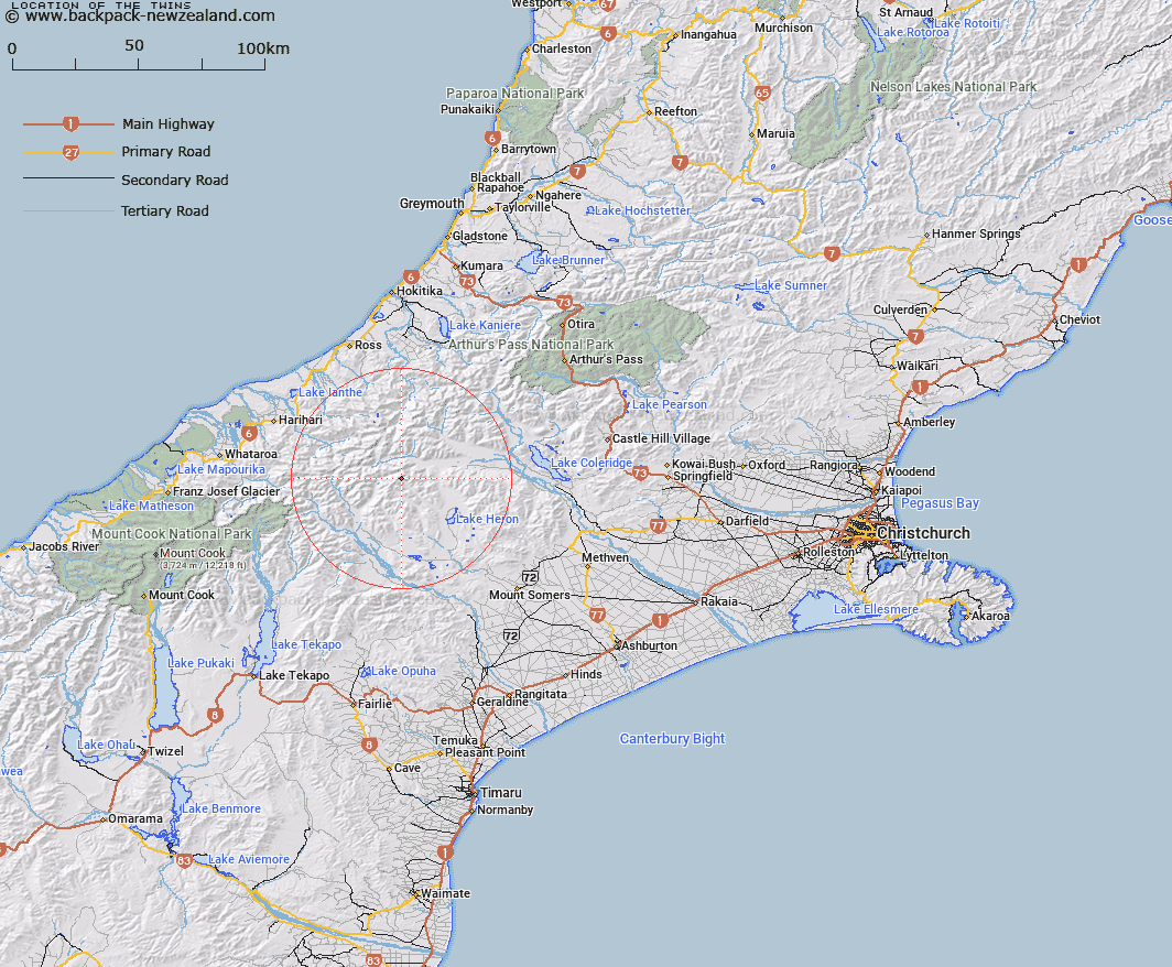
Map showing location of The Twins


LINZ description: Spectacular rock pinnacles on the Arrowsmith Range between Jagged Peak and Couloir Peak, height 2554m.
Latitude: -43.340822
Longitude: 170.997909
Northing: 5199390
Easting: 1437715.7
Land District: Canterbury
Feat Type: Hill


Scroll down to see a more detailed road map and below that a topographical map showing the location of The Twins. The road map has been supplied by openstreetmap and the topographical map of The Twins has been supplied by Land Information New Zealand (LINZ).

Yes you can use the top static map for you school/university project or personal website with a link back. Contact me for any commercial use.

The Twins Map New Zealand


New Zealand places in our database
[ A ] [ B ] [ C ] [ D ] [ E ] [ F ] [ G ] [ H ] [ I ] [ J ] [ K ] [ L ] [ M ] [ N ] [ O ] [ P ] [ Q ] [ R ] [ S ] [ T ] [ U ] [ V ] [ W ] [ X ] [ Y ] [ Z ]


Closest 20 Hills to The Twins

Couloir Peak ( 0.67km )   Tower Peak ( 0.99km )   Upham Peak ( 1.16km )   Jagged Peak ( 1.29km )   Tent Peak ( 1.85km )   Prop Peak ( 1.92km )   Lawrence Peak ( 1.97km )   East Horn Peak ( 2.38km )   Mount Arrowsmith ( 2.42km )   Red Peak ( 3.03km )   Mount Gould ( 3.11km )   North Peak ( 3.22km )   The Marquee ( 3.79km )   Spires Peak ( 4.06km )   Steeple Peak ( 4.1km )   Ashburton Peak ( 4.45km )   Bastion Peaks ( 4.57km )   Mount Murray ( 4.96km )   Hakatere Peak ( 5.44km )   Mount Medhurst ( 5.59km )   South Peak ( 5.88km )   Hells Gates ( 7.12km )   Jollie Sisters ( 7.24km )   Jollie Sisters Peaks ( 7.3km )   Pito Peak ( 7.76km )   Cascade Hill ( 8.05km )   Meins Knob ( 8.19km )   Jims Knob ( 9.1km )   Teddys Hill ( 9.15km )   Wild Mans Hill ( 9.44km )   Mount Renegade ( 10.16km )   Prospect Hill ( 10.22km )   Prelude Peak ( 10.28km )   Outlaw Peak ( 10.4km )   Mount Kinkel ( 11.25km )   Mount Butler ( 11.43km )   Middle Hill ( 11.5km )   Johnstone Mount ( 12km )   Pistol Peak ( 12.12km )   Totara Peak ( 12.17km )