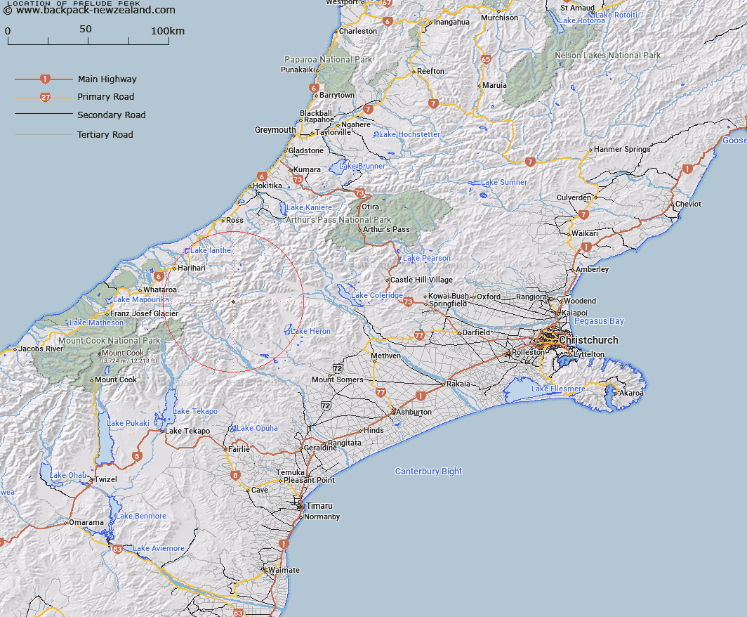
Map showing location of Prelude Peak


LINZ description: Peak East of Kirk Stream in the Lyell Valley, Rakaia headwaters, 2.5km East of Mount Goethe. Ramsay Survey District.
Latitude: -43.320867
Longitude: 170.873753
Northing: 5201357.2
Easting: 1427595.3
Land District: Canterbury
Feat Type: Hill


Scroll down to see a more detailed road map and below that a topographical map showing the location of Prelude Peak. The road map has been supplied by openstreetmap and the topographical map of Prelude Peak has been supplied by Land Information New Zealand (LINZ).

Yes you can use the top static map for you school/university project or personal website with a link back. Contact me for any commercial use.

Prelude Peak Map New Zealand


New Zealand places in our database
[ A ] [ B ] [ C ] [ D ] [ E ] [ F ] [ G ] [ H ] [ I ] [ J ] [ K ] [ L ] [ M ] [ N ] [ O ] [ P ] [ Q ] [ R ] [ S ] [ T ] [ U ] [ V ] [ W ] [ X ] [ Y ] [ Z ]


Closest 20 Hills to Prelude Peak

Mount Goethe ( 2.46km )   Pistol Peak ( 2.65km )   Bardolph Peak ( 2.94km )   Mount Renegade ( 2.96km )   Jollie Sisters Peaks ( 3.01km )   Jollie Sisters ( 3.08km )   Spearpoint Peak ( 3.37km )   Nym Peak ( 3.37km )   Outlaw Peak ( 3.47km )   Mount Kinkel ( 3.59km )   Warrior Peak ( 3.61km )   The Warrior ( 3.61km )   View Peak ( 3.7km )   Hells Gates ( 4.17km )   Amazon Peak ( 4.5km )   Blair Peak ( 4.56km )   Scimitar Peak ( 4.58km )   Review Peak ( 4.71km )   Meins Knob ( 4.83km )   Malcolm Peak ( 5.17km )   Hidden Peak ( 5.4km )   Mount Ramsay ( 5.47km )   Nicholson Peak ( 5.5km )   Johnstone Mount ( 6.22km )   Mount Westland ( 6.28km )   Bandit Peak ( 6.38km )   Jims Knob ( 6.39km )   Mount Stoddart ( 7.85km )   The Sentinel ( 7.97km )   Mount Lord ( 8.38km )   Mount Gould ( 8.4km )   Mount Murray ( 8.61km )   Ashburton Peak ( 8.97km )   Hakatere Peak ( 9.14km )   Mount Roberts ( 9.17km )   Mount Butler ( 9.17km )   Mount Arrowsmith ( 9.36km )   Red Peak ( 9.39km )   Dan Peak ( 9.49km )   Mount Jollie ( 9.59km )