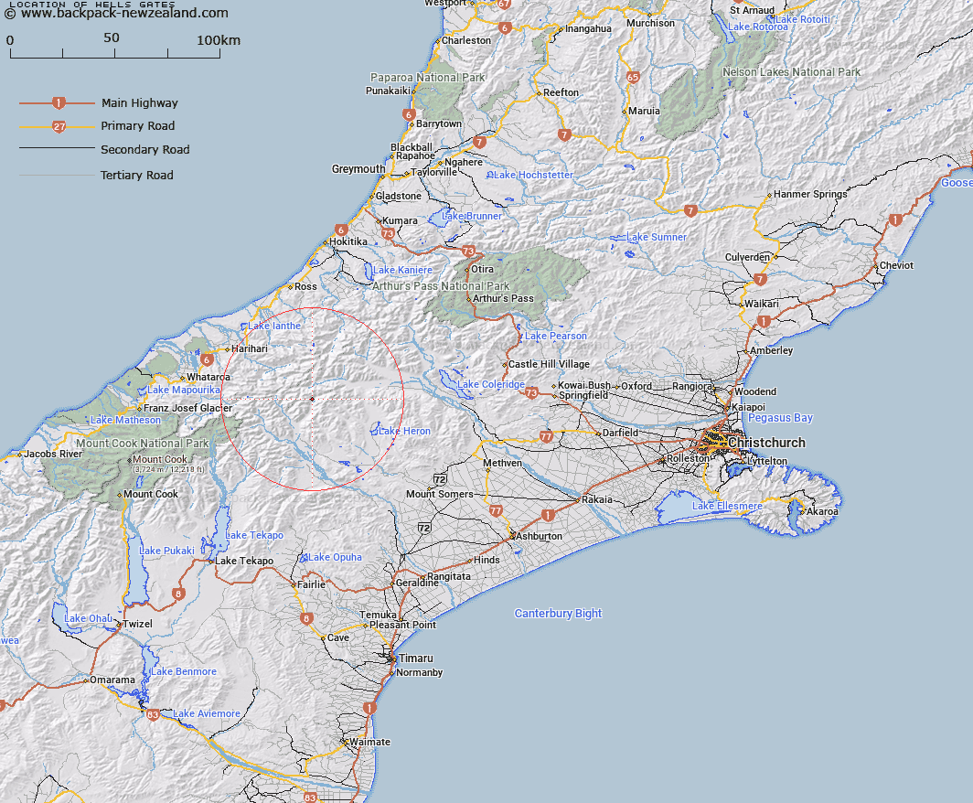
Map showing location of Hells Gates


LINZ description: Basin 1km off the riverbed in the headwaters area of Lawrence River, opposite Moses Creek. Block XI Ramsay Survey District.
Latitude: -43.347269
Longitude: 170.910366
Northing: 5198500
Easting: 1430637.5
Land District: Canterbury
Feat Type: Hill


Scroll down to see a more detailed road map and below that a topographical map showing the location of Hells Gates. The road map has been supplied by openstreetmap and the topographical map of Hells Gates has been supplied by Land Information New Zealand (LINZ).

Yes you can use the top static map for you school/university project or personal website with a link back. Contact me for any commercial use.

Hells Gates Map New Zealand


New Zealand places in our database
[ A ] [ B ] [ C ] [ D ] [ E ] [ F ] [ G ] [ H ] [ I ] [ J ] [ K ] [ L ] [ M ] [ N ] [ O ] [ P ] [ Q ] [ R ] [ S ] [ T ] [ U ] [ V ] [ W ] [ X ] [ Y ] [ Z ]


Closest 20 Hills to Hells Gates

Jollie Sisters Peaks ( 2.6km )   Jollie Sisters ( 2.68km )   Mount Renegade ( 3.05km )   Outlaw Peak ( 3.28km )   Prelude Peak ( 4.17km )   Ashburton Peak ( 4.86km )   Hakatere Peak ( 4.97km )   Pistol Peak ( 5.18km )   Bardolph Peak ( 5.3km )   Johnstone Mount ( 5.31km )   Warrior Peak ( 5.36km )   The Warrior ( 5.37km )   Nym Peak ( 5.41km )   Amazon Peak ( 5.56km )   Mount Arrowsmith ( 5.59km )   Spearpoint Peak ( 5.6km )   South Peak ( 5.7km )   Meins Knob ( 6.02km )   Mount Goethe ( 6.14km )   East Horn Peak ( 6.37km )   Mount Gould ( 6.38km )   Couloir Peak ( 6.45km )   Scimitar Peak ( 6.97km )   Mount Kinkel ( 6.99km )   Pito Peak ( 7km )   The Twins ( 7.12km )   View Peak ( 7.19km )   Bandit Peak ( 7.26km )   Red Peak ( 7.37km )   Mount Murray ( 7.53km )   Mount Jollie ( 7.81km )   Jims Knob ( 7.82km )   Tower Peak ( 7.9km )   Upham Peak ( 8.09km )   Jagged Peak ( 8.21km )   Review Peak ( 8.24km )   North Peak ( 8.46km )   Lawrence Peak ( 8.47km )   Blair Peak ( 8.51km )   Mount Ramsay ( 8.71km )