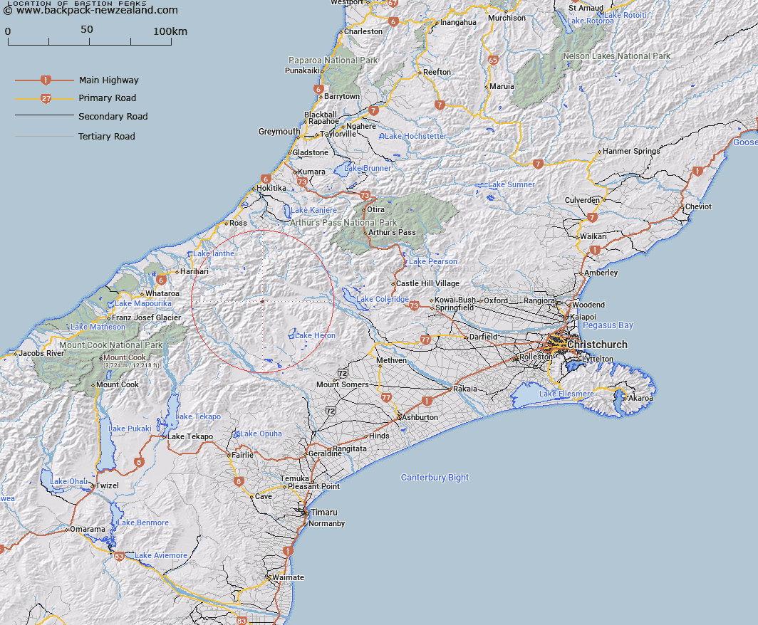
Map showing location of Bastion Peaks


LINZ description: Jutting out into the Rakaia from the arc of the main Arrowsmith Ridge
Latitude: -43.30139
Longitude: 171.013804
Northing: 5203800
Easting: 1438900
Land District: Canterbury
Feat Type: Hill


Scroll down to see a more detailed road map and below that a topographical map showing the location of Bastion Peaks. The road map has been supplied by openstreetmap and the topographical map of Bastion Peaks has been supplied by Land Information New Zealand (LINZ).

Yes you can use the top static map for you school/university project or personal website with a link back. Contact me for any commercial use.

Bastion Peaks Map New Zealand


New Zealand places in our database
[ A ] [ B ] [ C ] [ D ] [ E ] [ F ] [ G ] [ H ] [ I ] [ J ] [ K ] [ L ] [ M ] [ N ] [ O ] [ P ] [ Q ] [ R ] [ S ] [ T ] [ U ] [ V ] [ W ] [ X ] [ Y ] [ Z ]


Closest 20 Hills to Bastion Peaks

Spires Peak ( 0.79km )   Steeple Peak ( 1.03km )   Mount Medhurst ( 1.08km )   North Peak ( 1.48km )   Red Peak ( 2.44km )   Lawrence Peak ( 2.72km )   Mount Murray ( 3.07km )   Mount Gould ( 3.42km )   Jagged Peak ( 3.57km )   Upham Peak ( 3.64km )   Tower Peak ( 3.73km )   Prop Peak ( 3.75km )   The Twins ( 4.57km )   Tent Peak ( 4.58km )   Couloir Peak ( 4.85km )   The Marquee ( 5.38km )   Mount Arrowsmith ( 6.84km )   East Horn Peak ( 6.94km )   Jims Knob ( 7.57km )   Meins Knob ( 7.62km )   Cascade Hill ( 7.93km )   Totara Peak ( 8.12km )   Prospect Hill ( 8.16km )   Jollie Sisters ( 8.61km )   Jollie Sisters Peaks ( 8.71km )   Mount Butler ( 8.76km )   Ashburton Peak ( 8.79km )   Hakatere Peak ( 9.8km )   Hells Gates ( 9.8km )   Louper Peak ( 9.85km )   Lauper Peak ( 9.85km )   South Peak ( 10.34km )   Teddys Hill ( 10.42km )   Mount Kinkel ( 11.03km )   Mount Ramsay ( 11.26km )   Prelude Peak ( 11.54km )   Amazons Breasts ( 11.94km )   Mount Roberts ( 12.09km )   Hinge Peak ( 12.15km )   Pito Peak ( 12.27km )