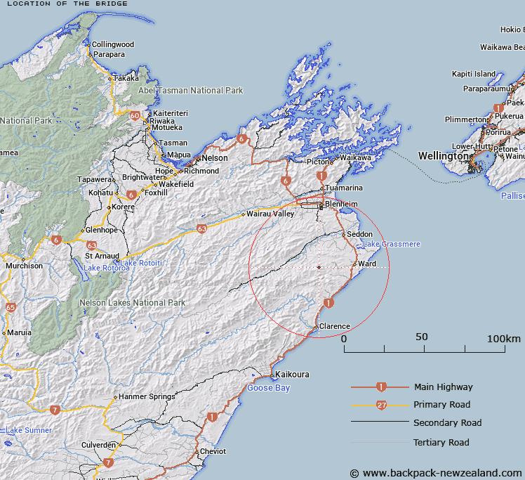
Map showing location of The Bridge


LINZ description: The ridge between Peggioh and Blue Mountain [Trig. O (Geodetic Code A41N)],in the Blue Mountain Range. Blue Mountain Survey District.
Latitude: -41.841974
Longitude: 173.942901
Northing: 5367339.3
Easting: 1678282.2
Land District: Marlborough
Feat Type: Ridge


Scroll down to see a more detailed road map and below that a topographical map showing the location of The Bridge. The road map has been supplied by openstreetmap and the topographical map of The Bridge has been supplied by Land Information New Zealand (LINZ).

Yes you can use the top static map for you school/university project or personal website with a link back. Contact me for any commercial use.

The Bridge Map New Zealand


New Zealand places in our database
[ A ] [ B ] [ C ] [ D ] [ E ] [ F ] [ G ] [ H ] [ I ] [ J ] [ K ] [ L ] [ M ] [ N ] [ O ] [ P ] [ Q ] [ R ] [ S ] [ T ] [ U ] [ V ] [ W ] [ X ] [ Y ] [ Z ]


Closest 20 Ridges to The Bridge

The Bridge ( 0km )   Iwitahi Ridge ( 8.97km )   Razorback Ridge ( 10.61km )   Limestone Ridge ( 20.5km )   Red Spur ( 20.55km )   The Islands ( 20.57km )   Hooper Ridge ( 21.66km )   McRae Spur ( 21.82km )   The Castles ( 23.47km )   Shoering Spur ( 24.07km )   Gibson Spur ( 24.67km )   Miser Spur ( 24.69km )   Orchard Spur ( 25.45km )   Bobs Spur ( 26.46km )   Tongue Spur ( 26.53km )   Billys Spur ( 27.06km )   Ben Spur ( 29.83km )   Rocky Gill Spur ( 30.23km )   George Spur ( 33.15km )   Junction Spur ( 37.48km )   Fidget Spur ( 45.69km )   Scarecrow Spur ( 45.95km )   The Black Spur ( 46.7km )   The Carriage Drive ( 48.24km )   Surveyor Spur ( 49.93km )   Davy Spur ( 53.01km )   Raven Spur ( 54.26km )   Canterbury Spur ( 54.55km )   Fork Spur ( 54.71km )   Sawyer Ridge ( 56.76km )   Saint Bernard Spur ( 57.82km )   Rough Spur ( 58.1km )   Snowflake Spur ( 58.54km )   Razorback Spur ( 59.13km )   Te Rakaomaru Spur ( 59.13km )   Te Hakuwai Spur ( 60.25km )   Scotties Spur ( 60.25km )   Fenceline Spur ( 62.08km )   Homestead Spur ( 62.33km )   Big Benledi ( 64.12km )