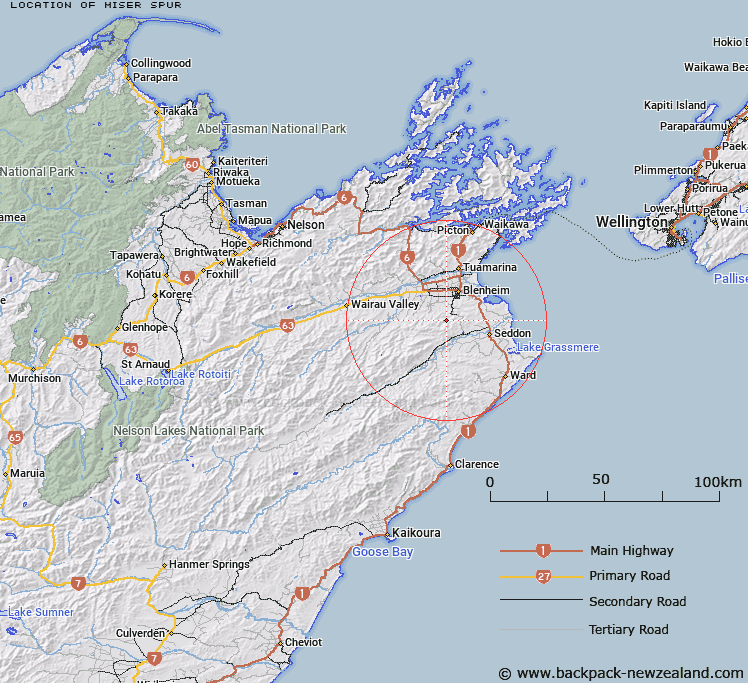
Map showing location of Miser Spur


LINZ description: A ridge between Dog Creek and Branch River, approximately 2 km north west of The Ned
Latitude: -41.621122
Longitude: 173.912532
Northing: 5391886.7
Easting: 1676020.7
Land District: Marlborough
Feat Type: Ridge


Scroll down to see a more detailed road map and below that a topographical map showing the location of Miser Spur. The road map has been supplied by openstreetmap and the topographical map of Miser Spur has been supplied by Land Information New Zealand (LINZ).

Yes you can use the top static map for you school/university project or personal website with a link back. Contact me for any commercial use.

Miser Spur Map New Zealand


New Zealand places in our database
[ A ] [ B ] [ C ] [ D ] [ E ] [ F ] [ G ] [ H ] [ I ] [ J ] [ K ] [ L ] [ M ] [ N ] [ O ] [ P ] [ Q ] [ R ] [ S ] [ T ] [ U ] [ V ] [ W ] [ X ] [ Y ] [ Z ]


Closest 20 Ridges to Miser Spur

Orchard Spur ( 3.04km )   The Islands ( 8km )   Hooper Ridge ( 11.02km )   The Castles ( 13.49km )   Billys Spur ( 23.71km )   The Bridge ( 24.69km )   Limestone Ridge ( 30.59km )   Razorback Ridge ( 33.45km )   Iwitahi Ridge ( 33.59km )   Rocky Gill Spur ( 35.83km )   Red Spur ( 39.79km )   McRae Spur ( 40.77km )   Tongue Spur ( 42.97km )   Shoering Spur ( 43.48km )   Gibson Spur ( 46.98km )   Bobs Spur ( 48.4km )   Ben Spur ( 51.98km )   Junction Spur ( 55.16km )   George Spur ( 55.74km )   Wells Ridge ( 56.34km )   Fork Spur ( 59.88km )   Boars Back Spur ( 60.57km )   Cummins Spur ( 60.85km )   Canterbury Spur ( 61.1km )   Bullock Spur ( 61.64km )   Scarecrow Spur ( 62.31km )   The Black Spur ( 63.64km )   Fidget Spur ( 65.8km )   The Carriage Drive ( 66.02km )   Gibbs Spur ( 69.92km )   Red Hills Ridge ( 71.26km )   Surveyor Spur ( 71.67km )   Davy Spur ( 72.88km )   Porter Ridge ( 73.86km )   Rough Spur ( 74.26km )   Saint Bernard Spur ( 74.46km )   Raven Spur ( 76.29km )   Sawyer Ridge ( 78.93km )   Snowflake Spur ( 79.49km )   Big Benledi ( 80.19km )