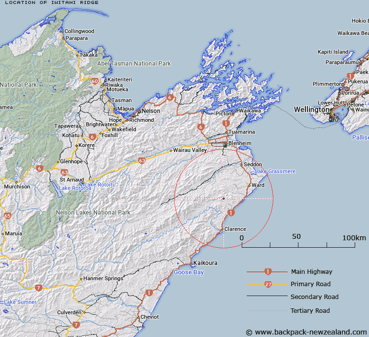
Map showing location of Iwitahi Ridge


LINZ description: Leading from Whernside Trig. Station in a north-easterly direction to a peak 812m in height, West of Brian Boru Stream. Block VIII, Whernside Survey District.
Latitude: -41.922598
Longitude: 173.938062
Northing: 5358392.1
Easting: 1677782.6
Land District: Marlborough
Feat Type: Ridge


Scroll down to see a more detailed road map and below that a topographical map showing the location of Iwitahi Ridge. The road map has been supplied by openstreetmap and the topographical map of Iwitahi Ridge has been supplied by Land Information New Zealand (LINZ).

Yes you can use the top static map for you school/university project or personal website with a link back. Contact me for any commercial use.

Iwitahi Ridge Map New Zealand


New Zealand places in our database
[ A ] [ B ] [ C ] [ D ] [ E ] [ F ] [ G ] [ H ] [ I ] [ J ] [ K ] [ L ] [ M ] [ N ] [ O ] [ P ] [ Q ] [ R ] [ S ] [ T ] [ U ] [ V ] [ W ] [ X ] [ Y ] [ Z ]


Closest 20 Ridges to Iwitahi Ridge

Razorback Ridge ( 5.68km )   The Bridge ( 8.97km )   Red Spur ( 16.09km )   Gibson Spur ( 17.19km )   McRae Spur ( 17.34km )   Shoering Spur ( 18.88km )   Bobs Spur ( 19.14km )   Ben Spur ( 22.19km )   Tongue Spur ( 22.99km )   Limestone Ridge ( 24.26km )   George Spur ( 25.12km )   The Islands ( 28.91km )   Hooper Ridge ( 29.47km )   The Castles ( 30.82km )   Rocky Gill Spur ( 31.65km )   Junction Spur ( 32.15km )   Billys Spur ( 32.17km )   Miser Spur ( 33.59km )   Orchard Spur ( 34.19km )   Fidget Spur ( 38.71km )   Scarecrow Spur ( 40.87km )   The Black Spur ( 41.29km )   Surveyor Spur ( 42.05km )   The Carriage Drive ( 42.36km )   Davy Spur ( 45.98km )   Raven Spur ( 46.19km )   Sawyer Ridge ( 48.6km )   Snowflake Spur ( 50.91km )   Te Rakaomaru Spur ( 51.06km )   Razorback Spur ( 51.06km )   Saint Bernard Spur ( 52.2km )   Te Hakuwai Spur ( 52.22km )   Scotties Spur ( 52.22km )   Rough Spur ( 52.7km )   Canterbury Spur ( 53.47km )   Fenceline Spur ( 54.08km )   Fork Spur ( 54.19km )   Homestead Spur ( 54.75km )   Big Benledi ( 58.61km )   Driving Spur ( 62.56km )