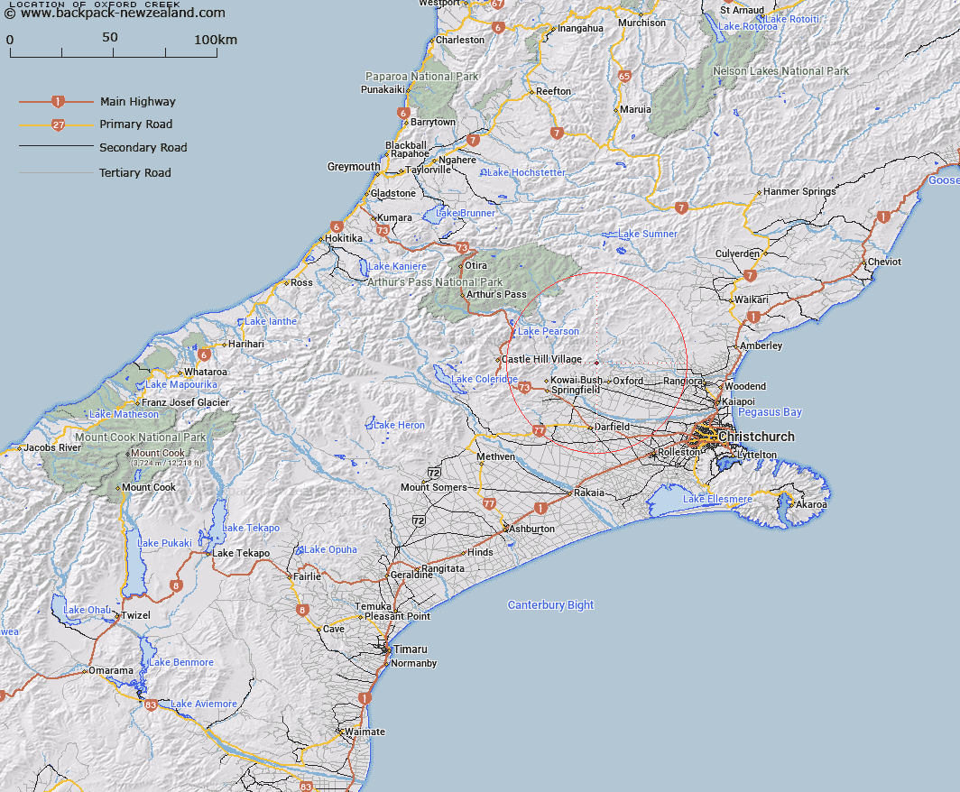
Map showing location of Oxford Creek


LINZ description: Stream rising from 1km north of the Ashley Saddle and flowing easterly into Ashley River, 500m upstream from Big Ben Stream. Upper Ashley Survey District.
Latitude: -43.221581
Longitude: 172.1394
Northing: 5214219.1
Easting: 1530106.4
Land District: Canterbury
Feat Type: Stream


Scroll down to see a more detailed road map and below that a topographical map showing the location of Oxford Creek. The road map has been supplied by openstreetmap and the topographical map of Oxford Creek has been supplied by Land Information New Zealand (LINZ).

Yes you can use the top static map for you school/university project or personal website with a link back. Contact me for any commercial use.

Oxford Creek Map New Zealand


New Zealand places in our database
[ A ] [ B ] [ C ] [ D ] [ E ] [ F ] [ G ] [ H ] [ I ] [ J ] [ K ] [ L ] [ M ] [ N ] [ O ] [ P ] [ Q ] [ R ] [ S ] [ T ] [ U ] [ V ] [ W ] [ X ] [ Y ] [ Z ]


Closest 20 Streams to Oxford Creek

Big Ben Stream ( 1.22km )   Keats Stream ( 2.01km )   Billy Stream ( 3.48km )   East Branch Coopers Creek ( 4.13km )   Harman Stream ( 4.87km )   Ladbrook Stream ( 5.19km )   Canary Stream ( 5.56km )   West Branch Coopers Creek ( 6.03km )   Dog Leg Stream ( 6.3km )   Moody Stream ( 6.38km )   Storm Stream ( 6.39km )   Richardson Stream ( 6.44km )   Five Gully Stream ( 6.65km )   Gammans Creek ( 6.96km )   Cascade Stream ( 7.24km )   Ashley Gorge Drain ( 7.8km )   Trout Stream ( 7.84km )   Ellis Drain ( 7.9km )   Coopers Creek ( 8.21km )   Shifton Stream ( 8.26km )   Dorman Stream ( 8.35km )   Mounseys Stream ( 8.38km )   Washpen Stream ( 8.38km )   Dobson Stream ( 8.48km )   Glentui River ( 9km )   Wharfedale Stream ( 9.01km )   Millton Stream ( 9.34km )   Snowdale Stream ( 9.84km )   Milton Stream ( 10.1km )   White Stream ( 10.31km )   Townshend River ( 10.34km )   Bald Hills Stream ( 10.85km )   Kingsdown Stream ( 10.93km )   Broom Stream ( 11.11km )   Eyre River ( 11.25km )   Coal Creek ( 11.86km )   Ribbonwood Stream ( 11.9km )   Garry River ( 12.2km )   Washpool Stream ( 12.38km )   Blowhard Stream ( 12.65km )