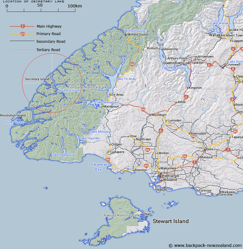
Map showing location of Secretary Lake


LINZ description: The largest lake on Secretary Island, situated 1km East by South-east of Mount Grono Trig. (Geodetic Code A0DW).
Latitude: -45.269134
Longitude: 166.966531
Northing: 4969415.3
Easting: 1126710.1
Land District: Southland
Feat Type: Lake


Scroll down to see a more detailed road map and below that a topographical map showing the location of Secretary Lake. The road map has been supplied by openstreetmap and the topographical map of Secretary Lake has been supplied by Land Information New Zealand (LINZ).

Yes you can use the top static map for you school/university project or personal website with a link back. Contact me for any commercial use.

Secretary Lake Map New Zealand


New Zealand places in our database
[ A ] [ B ] [ C ] [ D ] [ E ] [ F ] [ G ] [ H ] [ I ] [ J ] [ K ] [ L ] [ M ] [ N ] [ O ] [ P ] [ Q ] [ R ] [ S ] [ T ] [ U ] [ V ] [ W ] [ X ] [ Y ] [ Z ]


Closest 20 Lakes to Secretary Lake

Secretary Lake ( 0km )   Astelia Lake ( 6.33km )   Lake Dora ( 9.17km )   Lake Pan ( 9.62km )   Lake Chamberlain ( 14.19km )   Lake Browne ( 16.77km )   Teardrop Lake ( 18.28km )   Lake Paradise ( 22.54km )   Lake Norma ( 25.05km )   Lake Swan ( 25.99km )   Lake Troup ( 26.59km )   Hidden Lake ( 26.69km )   Lake Annie ( 26.94km )   Lake Lucy ( 27.84km )   Lake Matilda ( 28.65km )   Stump Lake ( 29.15km )   Lake Ione ( 29.26km )   Lake Eva ( 29.29km )   Lake Tuaraki ( 29.34km )   Lake Freeman ( 29.64km )   Lake Beattie ( 29.74km )   Lake Boomerang ( 30.63km )   Lake Minerva ( 30.63km )   Lake Mainwaring ( 30.7km )   Shirley Lake ( 31.54km )   Lake Shirley ( 31.61km )   Lake Hall ( 31.88km )   Lake Te Au ( 32.23km )   Lake Louise ( 32.42km )   Lake Cecil ( 32.42km )   Tawera Tarn ( 32.91km )   Lake Colwell ( 32.95km )   Lake Duncan ( 33.2km )   Lake Hilda ( 33.39km )   Lake Lucille ( 33.83km )   Lake Herries ( 34.22km )   Lake Carina ( 34.29km )   Myth Tarn ( 34.64km )   Lake Norwest ( 35.36km )   Lake Marchant ( 36.18km )