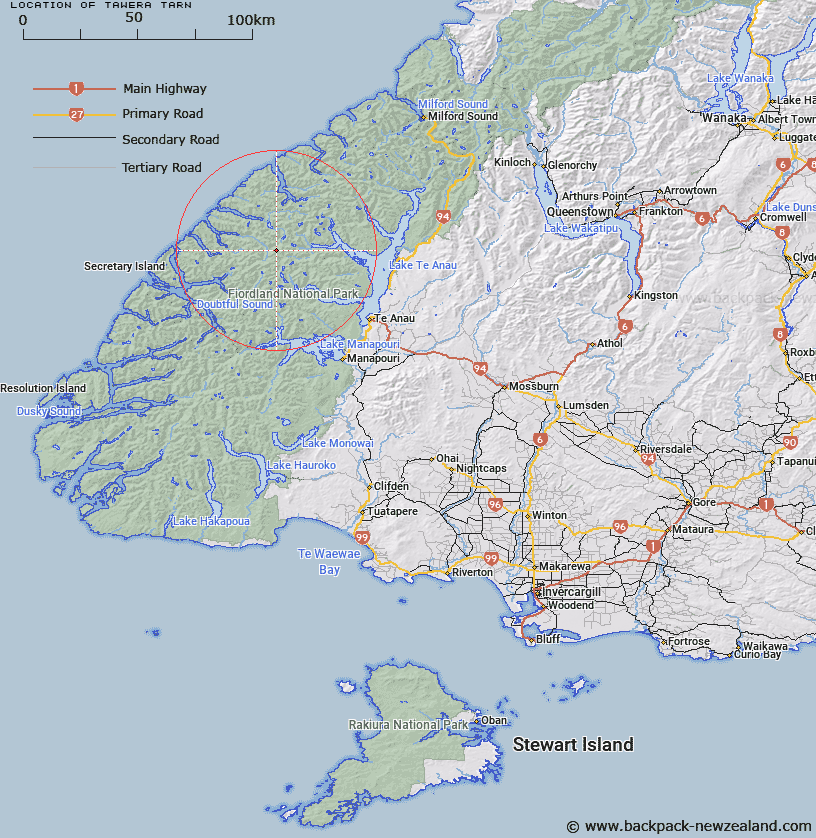
Map showing location of Tawera Tarn


LINZ description: Tarn approximately sixty chains north of Mount Irene, near the headwaters of Large Burn. Doon Survey District.
Latitude: -45.162976
Longitude: 167.358788
Northing: 4983442.8
Easting: 1156652.4
Land District: Southland
Feat Type: Lake


Scroll down to see a more detailed road map and below that a topographical map showing the location of Tawera Tarn. The road map has been supplied by openstreetmap and the topographical map of Tawera Tarn has been supplied by Land Information New Zealand (LINZ).

Yes you can use the top static map for you school/university project or personal website with a link back. Contact me for any commercial use.

Tawera Tarn Map New Zealand


New Zealand places in our database
[ A ] [ B ] [ C ] [ D ] [ E ] [ F ] [ G ] [ H ] [ I ] [ J ] [ K ] [ L ] [ M ] [ N ] [ O ] [ P ] [ Q ] [ R ] [ S ] [ T ] [ U ] [ V ] [ W ] [ X ] [ Y ] [ Z ]


Closest 20 Lakes to Tawera Tarn

Myth Tarn ( 3.76km )   Lake Mackinnon ( 5.43km )   Bloxham Lake ( 5.67km )   Lake Wisely ( 7.07km )   Lake Duncan ( 7.25km )   Hidden Lake ( 10.08km )   Lake Te Au ( 10.15km )   Lake Marchant ( 10.83km )   Lake Wapiti ( 12.82km )   Lake Ione ( 12.92km )   Eyles Lake ( 12.97km )   Lake Hilda ( 13.02km )   Lake Shirley ( 13.44km )   Lake Eva ( 13.6km )   Shirley Lake ( 13.64km )   Lake McIvor ( 14.24km )   Lake Hall ( 14.78km )   Teardrop Lake ( 14.9km )   Lake Boomerang ( 15.58km )   Lake Tuaraki ( 15.85km )   Lake Cecil ( 16.11km )   Welcome Lake ( 16.88km )   Lake Ogle ( 17.17km )   Lake Clark ( 17.27km )   Lake Minerva ( 18.21km )   Wade Lake ( 18.37km )   Three Duck Lake ( 19.06km )   Lake Katherine ( 19.35km )   Lake Thomson ( 19.71km )   Lake Freeman ( 20.03km )   Lake Hankinson ( 20.24km )   Deadwood Lagoon ( 20.62km )   Lake Norma ( 21.01km )   Lake Alice ( 22.46km )   Lake Herries ( 22.61km )   Lake Sutherland ( 24.47km )   Lake Dora ( 25.18km )   Lake Annie ( 25.2km )   Lake Pan ( 25.21km )   Orbell Lake ( 28.32km )