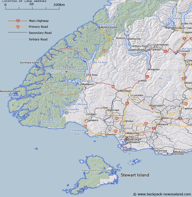
Map showing location of Lake Herries


LINZ description: Lake in Kepler Mountains. Approximately 6km north-west of Spire Peak. Drains into Lake Manapouri through Freeman Burn and Stevens Burn.
Latitude: -45.365698
Longitude: 167.382028
Northing: 4961050.7
Easting: 1160052.4
Land District: Southland
Feat Type: Lake


Scroll down to see a more detailed road map and below that a topographical map showing the location of Lake Herries. The road map has been supplied by openstreetmap and the topographical map of Lake Herries has been supplied by Land Information New Zealand (LINZ).

Yes you can use the top static map for you school/university project or personal website with a link back. Contact me for any commercial use.

Lake Herries Map New Zealand


New Zealand places in our database
[ A ] [ B ] [ C ] [ D ] [ E ] [ F ] [ G ] [ H ] [ I ] [ J ] [ K ] [ L ] [ M ] [ N ] [ O ] [ P ] [ Q ] [ R ] [ S ] [ T ] [ U ] [ V ] [ W ] [ X ] [ Y ] [ Z ]


Closest 20 Lakes to Lake Herries

Lake Freeman ( 4.77km )   Lake Minerva ( 5.03km )   Lake Cecil ( 6.51km )   Lake Boomerang ( 7.28km )   Lake Tuaraki ( 7.6km )   Lake Hall ( 7.83km )   Lake Victoria ( 8.22km )   Lake Annie ( 8.76km )   Lake Norma ( 9.17km )   Lake Eva ( 9.6km )   Lake Hilda ( 9.84km )   Lake Ione ( 10.24km )   Lake Norwest ( 11.98km )   Lake Te Au ( 12.5km )   Eyles Lake ( 14.56km )   Hidden Lake ( 14.62km )   Lake Duncan ( 15.61km )   Lake Richter ( 15.83km )   Lake Lois ( 16.63km )   Lake Matilda ( 17.19km )   Lake Lucille ( 17.61km )   Lake Wisely ( 17.7km )   Lake Lucy ( 17.76km )   Lake Virginia ( 18.06km )   Lake Carina ( 18.39km )   Trinity Lakes ( 18.74km )   Lake Manapouri ( 19.2km )   Lake Mainwaring ( 20.45km )   Teardrop Lake ( 21.28km )   Lake Percy ( 21.96km )   Tawera Tarn ( 22.61km )   Lake Troup ( 23.28km )   Orbell Lake ( 23.94km )   Lake Browne ( 24.5km )   Lake Colwell ( 24.97km )   Bloxham Lake ( 25.09km )   Lake Chamberlain ( 25.46km )   Myth Tarn ( 26.35km )   Lake Louise ( 26.99km )   Lake Henry ( 27.16km )