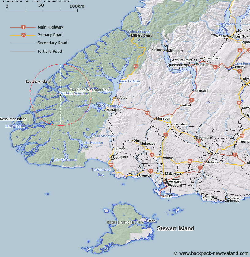
Map showing location of Lake Chamberlain


LINZ description: Lake approximately 1km in length situated north of Lake Browne, between Hall Arm and Crooked Arm, Doubtful Sound. 45.2030 S, 167.0330 E
Latitude: -45.379891
Longitude: 167.056779
Northing: 4957639.2
Easting: 1134700
Land District: Southland
Feat Type: Lake


Scroll down to see a more detailed road map and below that a topographical map showing the location of Lake Chamberlain. The road map has been supplied by openstreetmap and the topographical map of Lake Chamberlain has been supplied by Land Information New Zealand (LINZ).

Yes you can use the top static map for you school/university project or personal website with a link back. Contact me for any commercial use.

Lake Chamberlain Map New Zealand


New Zealand places in our database
[ A ] [ B ] [ C ] [ D ] [ E ] [ F ] [ G ] [ H ] [ I ] [ J ] [ K ] [ L ] [ M ] [ N ] [ O ] [ P ] [ Q ] [ R ] [ S ] [ T ] [ U ] [ V ] [ W ] [ X ] [ Y ] [ Z ]


Closest 20 Lakes to Lake Chamberlain

Lake Chamberlain ( 0km )   Lake Browne ( 2.58km )   Lake Troup ( 12.4km )   Lake Lucy ( 14.14km )   Secretary Lake ( 14.19km )   Lake Matilda ( 15.03km )   Stump Lake ( 16.12km )   Lake Mainwaring ( 16.63km )   Lake Annie ( 16.81km )   Lake Norma ( 17.2km )   Lake Louise ( 18.36km )   Lake Colwell ( 18.77km )   Lake Paradise ( 19.2km )   Lake Dora ( 19.25km )   Teardrop Lake ( 19.93km )   Lake Pan ( 19.96km )   Lake Lucille ( 20.14km )   Astelia Lake ( 20.48km )   Lake Carina ( 20.51km )   Lake Freeman ( 21.84km )   Lake Swan ( 22.02km )   Lake Norwest ( 22.84km )   Lake Tuaraki ( 23.52km )   Lake Minerva ( 23.63km )   Lake Percy ( 24.46km )   Hidden Lake ( 24.54km )   Lake Eva ( 24.56km )   Lake Boomerang ( 24.83km )   Lake Ione ( 24.86km )   Lake Virginia ( 24.96km )   Lake Beattie ( 25.38km )   Lake Herries ( 25.46km )   Lake Earnslaw ( 26.28km )   Lake Earnshaw ( 26.28km )   Lake Cecil ( 26.33km )   Lake Hall ( 26.38km )   Lake Lois ( 26.92km )   Gair Loch ( 27.43km )   Shy Lake ( 28.01km )   Lake Hilda ( 28.64km )