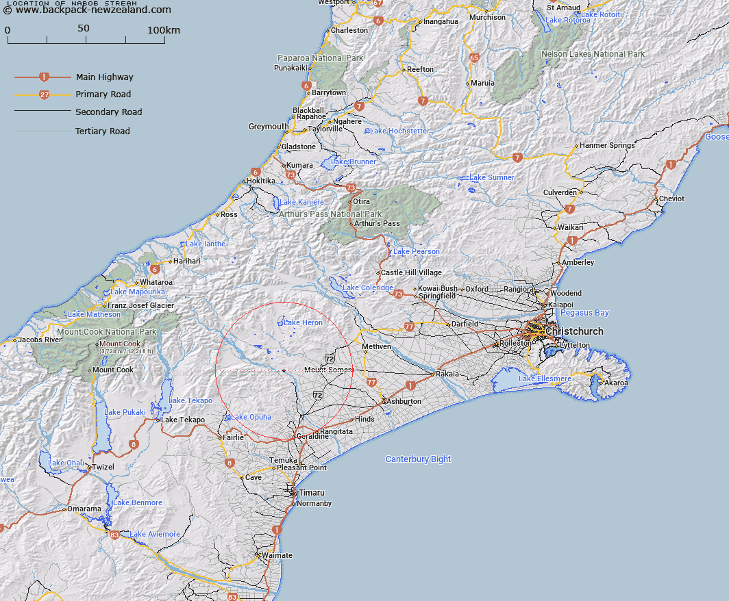
Map showing location of Nabob Stream


LINZ description: Left Bank tributary of Rangitata River rising in the Moorhouse Range 2.5km South-east of Brown Saddle, flowing southward and joining Rangitata River 2.5km West of Mount Pukanui [Trig. R (Geodetic Code ANF9)]. Block XV, Tripp Survey District.
Latitude: -43.735171
Longitude: 171.19088
Northing: 5155950
Easting: 1454310.7
Land District: Canterbury
Feat Type: Stream


Scroll down to see a more detailed road map and below that a topographical map showing the location of Nabob Stream. The road map has been supplied by openstreetmap and the topographical map of Nabob Stream has been supplied by Land Information New Zealand (LINZ).

Yes you can use the top static map for you school/university project or personal website with a link back. Contact me for any commercial use.

Nabob Stream Map New Zealand


New Zealand places in our database
[ A ] [ B ] [ C ] [ D ] [ E ] [ F ] [ G ] [ H ] [ I ] [ J ] [ K ] [ L ] [ M ] [ N ] [ O ] [ P ] [ Q ] [ R ] [ S ] [ T ] [ U ] [ V ] [ W ] [ X ] [ Y ] [ Z ]


Closest 20 Streams to Nabob Stream

Coal Creek ( 3.74km )   Hinds River South Branch ( 4.13km )   Middle Stream ( 4.42km )   Boundary Stream ( 4.79km )   Broadleaf Stream ( 5.54km )   Moorhouse Stream ( 5.6km )   Chaffey Stream ( 5.89km )   Little Hinds Stream ( 5.92km )   Soup Stream ( 5.97km )   Rangitata River ( 7.51km )   Middlestream ( 7.99km )   Sandrey Stream ( 8.35km )   Limestone Creek ( 8.52km )   Pudding Valley Creek ( 8.61km )   Chapmans Creek ( 9.23km )   Blondin Stream ( 10.27km )   Quartz Creek ( 10.47km )   Matagouri Stream ( 10.77km )   Saddle Hut Stream ( 10.97km )   Gawler Stream ( 11.34km )   Denny Stream ( 12km )   Waterfall Stream ( 12.17km )   Mount Peel Creek ( 12.41km )   Hinds River North Branch ( 12.45km )   Parson Stream ( 12.48km )   Emma Stream ( 12.55km )   Powerhouse Stream ( 12.59km )   Blue Duck Stream ( 12.65km )   Surrey Stream ( 12.74km )   Lynn Stream ( 13.08km )   Lodge Stream ( 13.33km )   Lambies Stream ( 13.43km )   Lochaber Stream ( 13.71km )   Woolshed Creek ( 13.73km )   Stony Creek ( 14.3km )   Stour River ( 14.61km )   Little Peel Stream ( 14.65km )   Chapmans Creek ( 14.68km )   Potato Stream ( 14.69km )   Rangitata Diversion Race ( 14.95km )