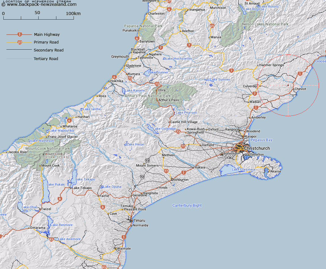
Map showing location of McPherson Stream


LINZ description: Stream rising 400m East of Leamington locality, flowing eastwards, and joining Caroline Stream 500m South-east of Trig. Sub Foy (Geodetic Code A6N9). Block VIII Lowry Peaks & Block IV Cheviot Survey Districts..
Latitude: -42.764471
Longitude: 173.211569
Northing: 5265318.1
Easting: 1617310.4
Land District: Canterbury
Feat Type: Stream


Scroll down to see a more detailed road map and below that a topographical map showing the location of McPherson Stream. The road map has been supplied by openstreetmap and the topographical map of McPherson Stream has been supplied by Land Information New Zealand (LINZ).

Yes you can use the top static map for you school/university project or personal website with a link back. Contact me for any commercial use.

McPherson Stream Map New Zealand


New Zealand places in our database
[ A ] [ B ] [ C ] [ D ] [ E ] [ F ] [ G ] [ H ] [ I ] [ J ] [ K ] [ L ] [ M ] [ N ] [ O ] [ P ] [ Q ] [ R ] [ S ] [ T ] [ U ] [ V ] [ W ] [ X ] [ Y ] [ Z ]


Closest 20 Streams to McPherson Stream

Hematite Stream ( 3.88km )   Swamp Stream ( 4.21km )   Gower River ( 4.99km )   Leamington Stream ( 4.99km )   Caroline Stream ( 5.51km )   Crystal Brook ( 5.59km )   Bruce Stream ( 7.31km )   Woolshed Stream ( 7.43km )   Athlone Stream ( 8.33km )   Catherine Stream ( 8.78km )   Sisters Stream ( 8.9km )   Catlin Stream ( 9.36km )   Marchlaw Stream ( 9.49km )   Jed River ( 10.12km )   Barnes Stream ( 10.25km )   Shingly Stream ( 10.79km )   Anstey Stream ( 11.05km )   Glen Albyn Stream ( 11.13km )   Cadman Stream ( 11.53km )   Bennett Stream ( 11.56km )   Dalziel Stream ( 11.67km )   Buxton Creek ( 11.9km )   Honeymoon Creek ( 12.71km )   Castaly Stream ( 12.81km )   Castaly River ( 13.15km )   Benmore Stream ( 14.31km )   Hawkswood Stream ( 14.96km )   Stanton River ( 14.97km )   Royal Stream ( 15km )   Kaiwara River ( 15.32km )   Bourne Stream ( 15.51km )   Medina River ( 15.77km )   Hookhamsnyvy Creek ( 15.86km )   Chilly Stream ( 16.55km )   Fern Flat Stream ( 16.87km )   Glen Jon Stream ( 17.02km )   Inverness Stream ( 17.22km )   Waingaro Stream ( 17.54km )   Rutherford Stream ( 17.75km )   Dawn Creek ( 19.26km )