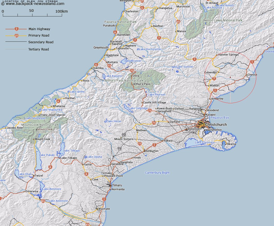
Map showing location of Glen Jon Stream


LINZ description: A tributary of Kaiwara River flowing from Lowry Peaks Range.
Latitude: -42.845531
Longitude: 173.034571
Northing: 5256337.9
Easting: 1602824.9
Land District: Canterbury
Feat Type: Stream


Scroll down to see a more detailed road map and below that a topographical map showing the location of Glen Jon Stream. The road map has been supplied by openstreetmap and the topographical map of Glen Jon Stream has been supplied by Land Information New Zealand (LINZ).

Yes you can use the top static map for you school/university project or personal website with a link back. Contact me for any commercial use.

Glen Jon Stream Map New Zealand


New Zealand places in our database
[ A ] [ B ] [ C ] [ D ] [ E ] [ F ] [ G ] [ H ] [ I ] [ J ] [ K ] [ L ] [ M ] [ N ] [ O ] [ P ] [ Q ] [ R ] [ S ] [ T ] [ U ] [ V ] [ W ] [ X ] [ Y ] [ Z ]


Closest 20 Streams to Glen Jon Stream

Kaiwara River ( 3.06km )   Benmore Stream ( 7.47km )   Black Creek ( 7.92km )   Cobbolds Creek ( 9.26km )   Greta River ( 9.92km )   Catherine Stream ( 10.14km )   Scargill Creek ( 11.94km )   Gower River ( 12.09km )   Leamington Stream ( 12.09km )   Blythe River ( 13.36km )   Swamp Stream ( 13.38km )   Crystal Brook ( 14.48km )   Tipapa Stream ( 14.71km )   Cave Creek ( 15.25km )   Black Birch Creek ( 15.78km )   Boundary Creek ( 16.18km )   School Creek ( 16.31km )   Bruce Stream ( 16.49km )   Cold Stream ( 16.78km )   Dry Stream ( 16.86km )   Manuka Creek ( 16.86km )   McPherson Stream ( 17.02km )   Honeymoon Creek ( 17.19km )   Hematite Stream ( 17.24km )   Cranky Tom Stream ( 17.28km )   Catlin Stream ( 17.71km )   Waikari River ( 18.32km )   Omihi Stream ( 19.24km )   Jimmys Creek ( 19.81km )   Jed River ( 20.25km )   Water Supply Creek ( 20.31km )   Buxton Creek ( 20.41km )   Caroline Stream ( 20.7km )   Marchlaw Stream ( 20.98km )   Anstey Stream ( 21.42km )   Woolshed Stream ( 21.73km )   Motunau River ( 21.98km )   Bourne Stream ( 23.12km )   Spurtelton Creek ( 23.36km )   Athlone Stream ( 23.51km )