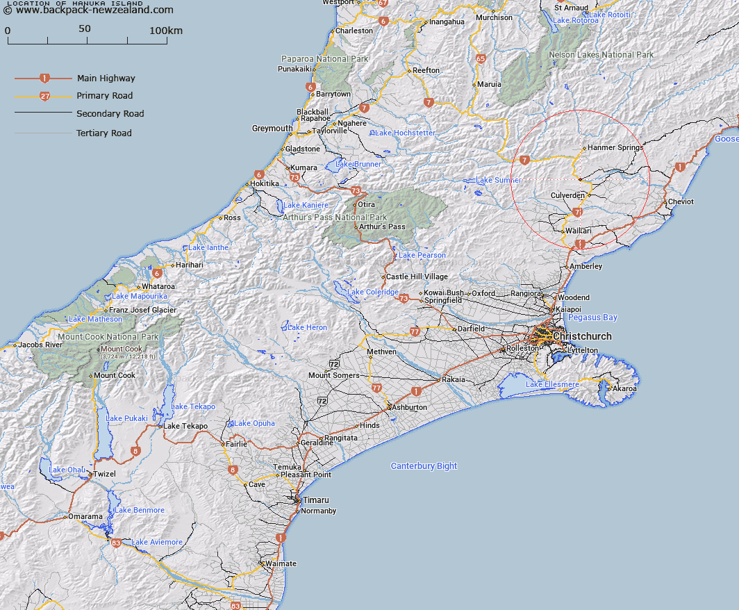
Map showing location of Manuka Island


LINZ description: A small island in the Waiau River supporting two bridges giving access to Emu Flats
Latitude: -42.692242
Longitude: 172.806849
Northing: 5273342.2
Easting: 1584178.3
Land District: Canterbury
Feat Type: Island


Scroll down to see a more detailed road map and below that a topographical map showing the location of Manuka Island. The road map has been supplied by openstreetmap and the topographical map of Manuka Island has been supplied by Land Information New Zealand (LINZ).

Yes you can use the top static map for you school/university project or personal website with a link back. Contact me for any commercial use.

Manuka Island Map New Zealand


New Zealand places in our database
[ A ] [ B ] [ C ] [ D ] [ E ] [ F ] [ G ] [ H ] [ I ] [ J ] [ K ] [ L ] [ M ] [ N ] [ O ] [ P ] [ Q ] [ R ] [ S ] [ T ] [ U ] [ V ] [ W ] [ X ] [ Y ] [ Z ]


Closest 20 Islands to Manuka Island

Cabbage Tree Island ( 5.11km )   Garden Island ( 7.69km )   Shag Rock ( 46.54km )   Motunau Island ( 46.69km )   Pukaroro Rock ( 59.59km )   Otumatu Rock ( 63.47km )   Rileys Lookout (Panau Island) ( 66.65km )   Browns Rock ( 96.49km )   Beacon Rock ( 101.24km )   Ripa Island ( 103.26km )   Ripapa Island ( 103.26km )   Pukerauaruhe Island ( 103.93km )   Quail Island (Otamahua) ( 104.59km )   Otamahua/Quail Island ( 104.59km )   King Billy Island ( 105.29km )   Horomaka Island ( 106.49km )   Horomonga Island ( 106.49km )   Refuge Island/Takataka ( 109.5km )   Refuge Island ( 109.5km )   Sail Rocks ( 112.63km )   Pa Island ( 114.18km )   Long Boat ( 118.92km )   Killeen Island ( 120.58km )   Crown Island ( 125.15km )   Jachin Island ( 129.57km )   Pompeys Pillar ( 131.02km )   Whale Island ( 132.45km )   The Long Boat ( 133.91km )   Cobden Island ( 134.33km )   Shag Rock ( 134.76km )   Big Rock ( 134.86km )   Hans Island ( 136.35km )   Organs Island ( 139.15km )   Seal Island ( 139.28km )   Rakaia Island ( 139.37km )   Chair Rock ( 142.59km )   Torea Rocks ( 142.66km )   Lovers Rock ( 142.77km )   Martin Island ( 144.49km )   Warrigal Island ( 144.74km )