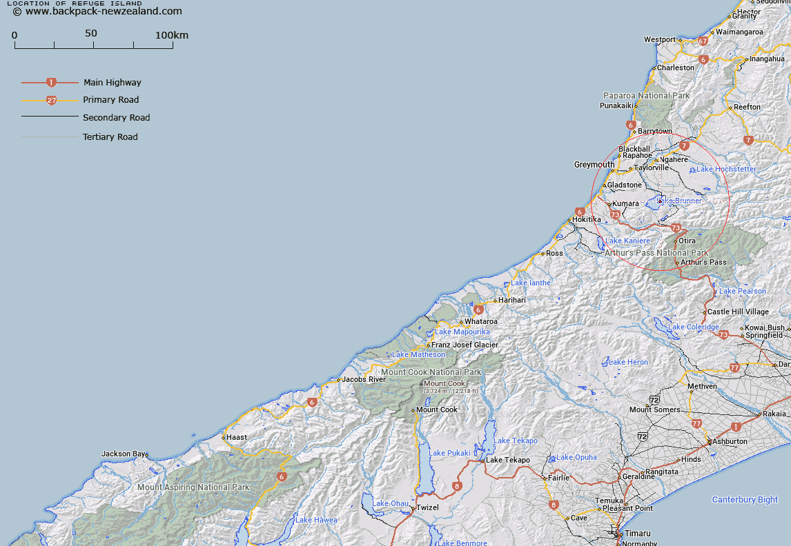
Map showing location of Refuge Island


LINZ description: Feature shown on: NZMS260-K32 846421; NZTopo50-BU20 746805;
Latitude: -42.617741
Longitude: 171.471661
Northing: 5280501
Easting: 1474656.9
Land District: Westland
Feat Type: Island


Scroll down to see a more detailed road map and below that a topographical map showing the location of Refuge Island. The road map has been supplied by openstreetmap and the topographical map of Refuge Island has been supplied by Land Information New Zealand (LINZ).

Yes you can use the top static map for you school/university project or personal website with a link back. Contact me for any commercial use.

Refuge Island Map New Zealand


New Zealand places in our database
[ A ] [ B ] [ C ] [ D ] [ E ] [ F ] [ G ] [ H ] [ I ] [ J ] [ K ] [ L ] [ M ] [ N ] [ O ] [ P ] [ Q ] [ R ] [ S ] [ T ] [ U ] [ V ] [ W ] [ X ] [ Y ] [ Z ]


Closest 20 Islands to Refuge Island

Killeen Island ( 19.63km )   Cobden Island ( 29.43km )   Big Rock ( 34.04km )   Hans Island ( 34.1km )   Shag Rock ( 34.39km )   Cashmere Island ( 56.94km )   Tui Island ( 57.3km )   Frenchies Island ( 58.76km )   Seal Island ( 65.68km )   Walkers Island ( 77.22km )   Organs Island ( 90.92km )   Wall Island ( 94.74km )   Martin Island ( 96.55km )   Browns Rock ( 97.84km )   Black Reef ( 98.98km )   Three Steeples ( 99.58km )   Sunbeam Island ( 106.02km )   Cabbage Tree Island ( 106.11km )   Garden Island ( 106.41km )   Te Waipounamu ( 107.48km )   South Island ( 107.48km )   Manuka Island ( 109.5km )   Chair Rock ( 115.42km )   Torea Rocks ( 115.59km )   Lovers Rock ( 115.78km )   Warrigal Island ( 126.43km )   Motunau Island ( 140km )   Rakaia Island ( 148.94km )   Otamahua/Quail Island ( 149.66km )   Quail Island (Otamahua) ( 149.66km )   King Billy Island ( 150km )   Ripa Island ( 152.52km )   Ripapa Island ( 152.52km )   Shag Rock ( 155.11km )   Pukerauaruhe Island ( 157.11km )   Beacon Rock ( 157.18km )   Horomaka Island ( 159.16km )   Horomonga Island ( 159.16km )   Motuariki Island ( 165.69km )   Rangitata Island ( 166.53km )