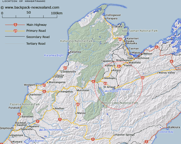
Map showing location of Mangatāwhai
LINZ description: An historic locality at the intersection of Tophouse Road and Korere Tophouse Road north of Tophouse Settlement approximately 6 km northeast of St Arnaud. NZTopo50-BR25 917770.
Latitude: -41.758081
Longitude: 172.900389
Northing: 5377078.4
Easting: 1591719.3
Land District: Nelson
Feat Type: Locality
Latitude: -41.758081
Longitude: 172.900389
Northing: 5377078.4
Easting: 1591719.3
Land District: Nelson
Feat Type: Locality

Scroll down to see a more detailed road map and below that a topographical map showing the location of Mangatāwhai. The road map has been supplied by openstreetmap and the topographical map of Mangatāwhai has been supplied by Land Information New Zealand (LINZ).
Yes you can use the top static map for you school/university project or personal website with a link back. Contact me for any commercial use.
[ A ] [ B ] [ C ] [ D ] [ E ] [ F ] [ G ] [ H ] [ I ] [ J ] [ K ] [ L ] [ M ] [ N ] [ O ] [ P ] [ Q ] [ R ] [ S ] [ T ] [ U ] [ V ] [ W ] [ X ] [ Y ] [ Z ]