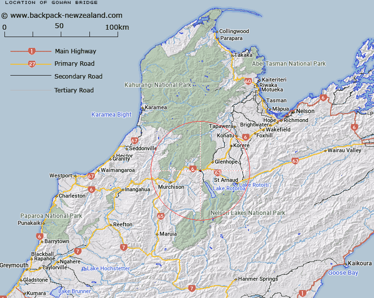
Map showing location of Gowan Bridge


LINZ description: Locality at the junction of the Buller and Gowan Rivers. Hope Survey District.
Latitude: -41.713096
Longitude: 172.555356
Northing: 5381982.1
Easting: 1563010.7
Land District: Nelson
Feat Type: Locality


Scroll down to see a more detailed road map and below that a topographical map showing the location of Gowan Bridge. The road map has been supplied by openstreetmap and the topographical map of Gowan Bridge has been supplied by Land Information New Zealand (LINZ).

Yes you can use the top static map for you school/university project or personal website with a link back. Contact me for any commercial use.

Gowan Bridge Map New Zealand


New Zealand places in our database
[ A ] [ B ] [ C ] [ D ] [ E ] [ F ] [ G ] [ H ] [ I ] [ J ] [ K ] [ L ] [ M ] [ N ] [ O ] [ P ] [ Q ] [ R ] [ S ] [ T ] [ U ] [ V ] [ W ] [ X ] [ Y ] [ Z ]


Closest 20 Localitys to Gowan Bridge

Gowanbridge ( 0km )   Gowan Bridge ( 0km )   Owen Junction ( 5.06km )   Kawatiri ( 5.51km )   Howard Junction ( 7.17km )   Owen River ( 9.33km )   Rotoroa ( 9.76km )   Glenhope ( 10.57km )   Howard ( 10.65km )   Tutaki ( 14.25km )   Longford ( 17.63km )   Mangles Valley ( 18.23km )   Atapo ( 22.29km )   Kaka ( 22.31km )   Four Rivers Plain ( 22.92km )   Tui ( 23.66km )   Pinchback ( 25.82km )   St Arnaud ( 25.93km )   Lake Rotoiti ( 25.93km )   Six Mile ( 26.42km )   Kikiwa ( 27.16km )   Kiwi ( 28.3km )   Korere ( 28.61km )   Mangat?whai ( 29.06km )   Tophouse ( 29.25km )   Glengarry ( 29.39km )   Ariki ( 29.75km )   Tophouse Settlement ( 30.29km )   Shenandoah ( 30.33km )   Golden Downs ( 33.28km )   Newton Flat ( 33.73km )   Matakitaki ( 34.12km )   Tadmor ( 34.73km )   Te Araruahinewai ( 35.49km )   Motupiko ( 35.58km )   Minehaha ( 35.66km )   Matariki ( 35.83km )   Dip Flat ( 36.23km )   Upper Matakitaki ( 37.13km )   Hiwipango ( 38.29km )