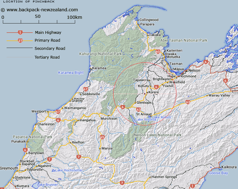
Map showing location of Pinchback
LINZ description: Hill (648m), Trig. D (Geodetic Code A4KV) situated on summit, on Pinchback Range. 2.8km South-west of Korere locality. Blocks VIII and XII Tadmor Survey District.
Latitude: -41.542984
Longitude: 172.766819
Northing: 5400937.5
Easting: 1580550.9
Land District: Nelson
Feat Type: Locality
Latitude: -41.542984
Longitude: 172.766819
Northing: 5400937.5
Easting: 1580550.9
Land District: Nelson
Feat Type: Locality

Scroll down to see a more detailed road map and below that a topographical map showing the location of Pinchback. The road map has been supplied by openstreetmap and the topographical map of Pinchback has been supplied by Land Information New Zealand (LINZ).
Yes you can use the top static map for you school/university project or personal website with a link back. Contact me for any commercial use.
[ A ] [ B ] [ C ] [ D ] [ E ] [ F ] [ G ] [ H ] [ I ] [ J ] [ K ] [ L ] [ M ] [ N ] [ O ] [ P ] [ Q ] [ R ] [ S ] [ T ] [ U ] [ V ] [ W ] [ X ] [ Y ] [ Z ]