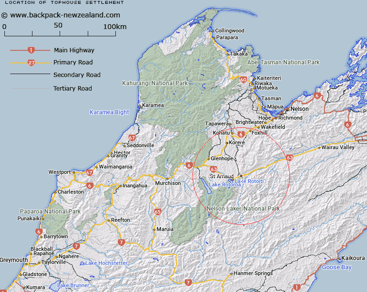
Map showing location of Tophouse Settlement
LINZ description: New locality, approximately 7km north-east of Saint Arnaud, along State Highway No.63.
Latitude: -41.77861
Longitude: 172.909752
Northing: 5374800
Easting: 1592500
Land District: Nelson
Feat Type: Locality
Latitude: -41.77861
Longitude: 172.909752
Northing: 5374800
Easting: 1592500
Land District: Nelson
Feat Type: Locality

Scroll down to see a more detailed road map and below that a topographical map showing the location of Tophouse Settlement. The road map has been supplied by openstreetmap and the topographical map of Tophouse Settlement has been supplied by Land Information New Zealand (LINZ).
Yes you can use the top static map for you school/university project or personal website with a link back. Contact me for any commercial use.
[ A ] [ B ] [ C ] [ D ] [ E ] [ F ] [ G ] [ H ] [ I ] [ J ] [ K ] [ L ] [ M ] [ N ] [ O ] [ P ] [ Q ] [ R ] [ S ] [ T ] [ U ] [ V ] [ W ] [ X ] [ Y ] [ Z ]