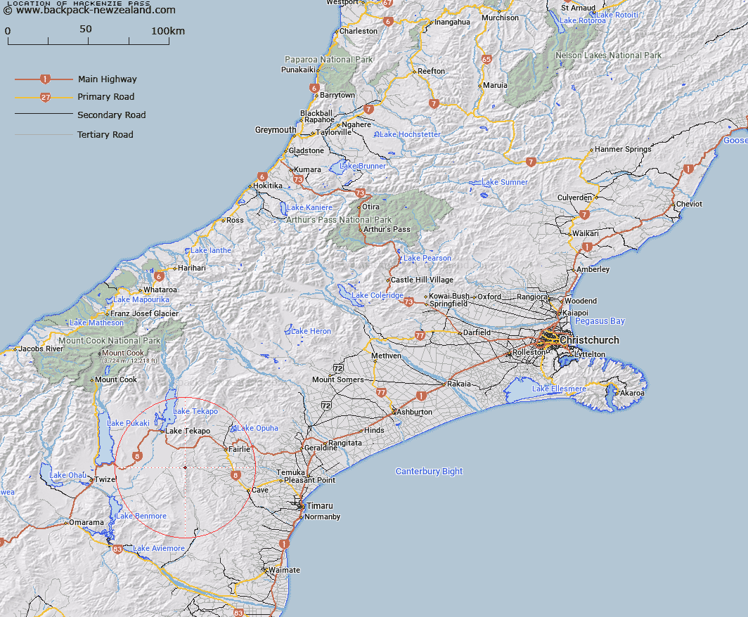
Map showing location of Mackenzie Pass


LINZ description: Feature shown on: NZMS260-I38 190656; NZTopo50-BZ17 090039;
Latitude: -44.193116
Longitude: 170.609939
Northing: 5103900
Easting: 1409000
Land District: Canterbury
Feat Type: Pass


Scroll down to see a more detailed road map and below that a topographical map showing the location of Mackenzie Pass. The road map has been supplied by openstreetmap and the topographical map of Mackenzie Pass has been supplied by Land Information New Zealand (LINZ).

Yes you can use the top static map for you school/university project or personal website with a link back. Contact me for any commercial use.

Mackenzie Pass Map New Zealand


New Zealand places in our database
[ A ] [ B ] [ C ] [ D ] [ E ] [ F ] [ G ] [ H ] [ I ] [ J ] [ K ] [ L ] [ M ] [ N ] [ O ] [ P ] [ Q ] [ R ] [ S ] [ T ] [ U ] [ V ] [ W ] [ X ] [ Y ] [ Z ]


Closest 20 Passs to Mackenzie Pass

Waratah Saddle ( 4.85km )   Burke Pass ( 11.47km )   Burkes Pass ( 11.47km )   Hakataramea Pass ( 13.4km )   Big Pass ( 24.51km )   Tekapo Saddle ( 25.17km )   Simons Pass ( 25.66km )   Little Pass ( 25.91km )   Dover Pass ( 31.53km )   Stoneleigh Saddle ( 33.52km )   Waitohi Saddle ( 34.75km )   Staircase Saddle ( 34.89km )   Meikleburn Saddle ( 42.87km )   Blue Mountain Pass ( 43.52km )   Montys Saddle ( 44.37km )   Butler Saddle ( 49.44km )   Stag Saddle ( 52.92km )   Flanagan Pass ( 54.11km )   Bullock Bow Saddle ( 54.64km )   Cow Block Saddle ( 59.05km )   Jamieson Saddle ( 63.6km )   Jollie Saddle ( 63.96km )   Abbey Pass ( 64.22km )   Helen Col ( 65.39km )   Ailsa Pass ( 65.42km )   Kehua Pass ( 65.46km )   Barrow Col ( 65.56km )   Sladden Saddle ( 66.25km )   Tragedy Col ( 66.46km )   Rutherford Pass ( 66.49km )   Brabazon Saddle ( 66.83km )   Tom Thumb Col ( 66.91km )   Rankin Pass ( 66.96km )   Waihi Pass ( 67.13km )   Faith Col ( 67.15km )   Athene Col ( 67.65km )   Billiken Pass ( 67.93km )   Gunbarrel Pass ( 68.53km )   Gunsight Pass ( 68.53km )   Balmacaan Saddle ( 68.56km )