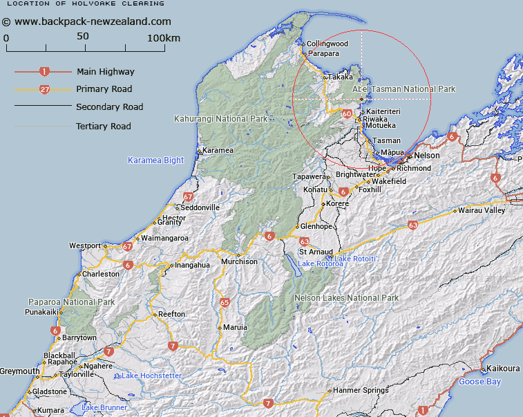
Map showing location of Holyoake Clearing
LINZ description: Clearing North of Rata Hill, [Trig. Z (Geodetic Code A73G)], Abel Tasman National Park. Block VI Kaiteriteri Survey District.
Latitude: -40.966348
Longitude: 173.006865
Northing: 5464978.6
Easting: 1600577.7
Land District: Nelson
Feat Type: Clearing
Latitude: -40.966348
Longitude: 173.006865
Northing: 5464978.6
Easting: 1600577.7
Land District: Nelson
Feat Type: Clearing

Scroll down to see a more detailed road map and below that a topographical map showing the location of Holyoake Clearing. The road map has been supplied by openstreetmap and the topographical map of Holyoake Clearing has been supplied by Land Information New Zealand (LINZ).
Yes you can use the top static map for you school/university project or personal website with a link back. Contact me for any commercial use.
[ A ] [ B ] [ C ] [ D ] [ E ] [ F ] [ G ] [ H ] [ I ] [ J ] [ K ] [ L ] [ M ] [ N ] [ O ] [ P ] [ Q ] [ R ] [ S ] [ T ] [ U ] [ V ] [ W ] [ X ] [ Y ] [ Z ]