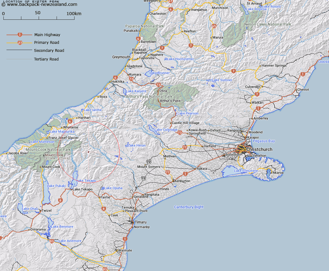
Map showing location of Exeter Peak


LINZ description: On the Two Thumb Range. West of Mount Alma
Latitude: -43.553713
Longitude: 170.699519
Northing: 5175122.2
Easting: 1414181.5
Land District: Canterbury
Feat Type: Hill


Scroll down to see a more detailed road map and below that a topographical map showing the location of Exeter Peak. The road map has been supplied by openstreetmap and the topographical map of Exeter Peak has been supplied by Land Information New Zealand (LINZ).

Yes you can use the top static map for you school/university project or personal website with a link back. Contact me for any commercial use.

Exeter Peak Map New Zealand


New Zealand places in our database
[ A ] [ B ] [ C ] [ D ] [ E ] [ F ] [ G ] [ H ] [ I ] [ J ] [ K ] [ L ] [ M ] [ N ] [ O ] [ P ] [ Q ] [ R ] [ S ] [ T ] [ U ] [ V ] [ W ] [ X ] [ Y ] [ Z ]


Closest 20 Hills to Exeter Peak

Alma ( 2.24km )   Graf Spee ( 2.45km )   High Peak ( 2.62km )   Myrmidon ( 2.73km )   Achilles Peak ( 2.77km )   Low Peak ( 2.78km )   Priam ( 3.13km )   Tantalus ( 3.38km )   Mount Chevalier ( 4.24km )   Electra Peak ( 4.68km )   Ajax Peak ( 4.76km )   The Thumbs ( 4.91km )   Mount Ross ( 6.21km )   Split Peaks ( 6.48km )   Paris ( 6.75km )   Mount Caton ( 7.34km )   Finlay Hill ( 8.1km )   Mount Pattisson ( 8.71km )   East Sentinel ( 9km )   Black Mountain ( 9.52km )   Captains Peak ( 9.98km )   Mount Brabazon ( 10.44km )   Mount Earle ( 11.1km )   Mount Forbes ( 11.11km )   Ferrar Peak ( 11.61km )   Mount Sibbald ( 11.67km )   Cloudy Peak ( 12.16km )   Mount Coates ( 12.49km )   Mount Nolan ( 12.67km )   Mount McMillan ( 13.03km )   Oklahoma ( 13.06km )   The Onlooker ( 13.09km )   Mount Onslow ( 13.14km )   Mount Toby ( 13.31km )   Mount D'Archiac ( 13.71km )   Mount Sinclair ( 13.76km )   The Commander ( 13.85km )   Pyramus Peak ( 14.19km )   McClure Peak ( 15.15km )   Observation Hill ( 15.26km )