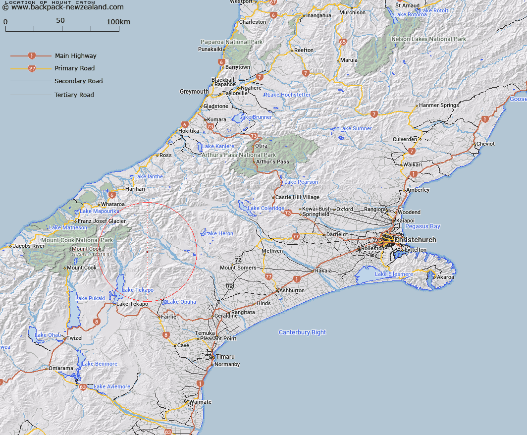
Map showing location of Mount Caton


LINZ description: Peak (2309m) at the intersection of the Two Thumb Range and the Brabazon range, 2km North North-east of Mount Pattisson. Block VIII Sinclair Survey District.
Latitude: -43.612579
Longitude: 170.740876
Northing: 5168676
Easting: 1417700
Land District: Canterbury
Feat Type: Hill


Scroll down to see a more detailed road map and below that a topographical map showing the location of Mount Caton. The road map has been supplied by openstreetmap and the topographical map of Mount Caton has been supplied by Land Information New Zealand (LINZ).

Yes you can use the top static map for you school/university project or personal website with a link back. Contact me for any commercial use.

Mount Caton Map New Zealand


New Zealand places in our database
[ A ] [ B ] [ C ] [ D ] [ E ] [ F ] [ G ] [ H ] [ I ] [ J ] [ K ] [ L ] [ M ] [ N ] [ O ] [ P ] [ Q ] [ R ] [ S ] [ T ] [ U ] [ V ] [ W ] [ X ] [ Y ] [ Z ]


Closest 20 Hills to Mount Caton

Split Peaks ( 0.88km )   Mount Pattisson ( 2.05km )   The Thumbs ( 2.43km )   Electra Peak ( 2.88km )   Paris ( 3.72km )   Tantalus ( 4.05km )   Captains Peak ( 4.06km )   Priam ( 4.22km )   Myrmidon ( 4.65km )   High Peak ( 5.02km )   Achilles Peak ( 5.07km )   Low Peak ( 5.33km )   Mount Brabazon ( 5.59km )   Alma ( 6.49km )   Mount Sinclair ( 7.13km )   Mount Toby ( 7.15km )   Exeter Peak ( 7.34km )   Black Mountain ( 7.57km )   Mount Ross ( 7.65km )   Ajax Peak ( 7.98km )   Mount Chevalier ( 8.68km )   Graf Spee ( 9.52km )   Beuzenberg Peak ( 12.44km )   Mount Hope ( 13.16km )   Braun-Elwert Peak ( 13.6km )   High Terrace ( 13.69km )   Observation Hill ( 14.07km )   Mount Sunday ( 14.21km )   Finlay Hill ( 15.3km )   East Sentinel ( 16.25km )   Ferrar Peak ( 16.25km )   Mount Sibbald ( 16.44km )   Mount Erebus ( 16.56km )   Mount Nolan ( 16.79km )   Cloudy Peak ( 17.14km )   Sibbald Knobs ( 17.26km )   Neutral Hill ( 17.4km )   Mount Gerald ( 17.54km )   Mount Caroline ( 17.55km )   Mount Forbes ( 17.95km )