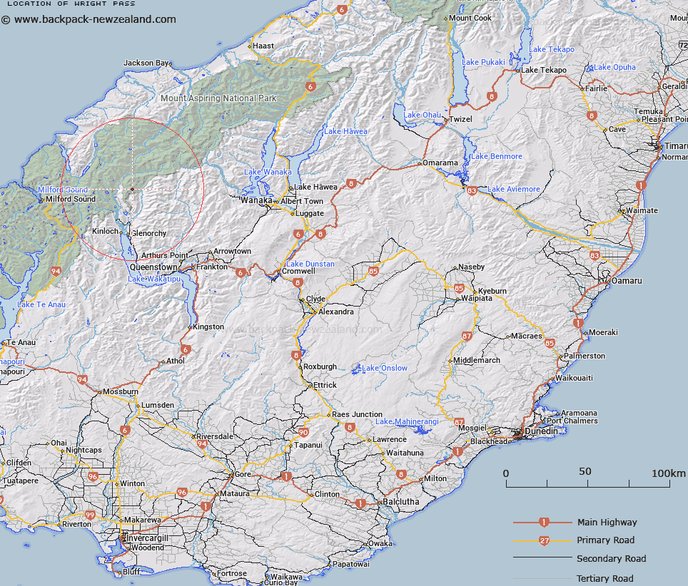
Map showing location of Wright Pass


LINZ description: Map shows Col, Gazette shows Pass, added to Gazette Ammendment List.
Latitude: -44.61648
Longitude: 168.410919
Northing: 5049400
Easting: 1235900
Land District: Otago
Feat Type: Pass


Scroll down to see a more detailed road map and below that a topographical map showing the location of Wright Pass. The road map has been supplied by openstreetmap and the topographical map of Wright Pass has been supplied by Land Information New Zealand (LINZ).

Yes you can use the top static map for you school/university project or personal website with a link back. Contact me for any commercial use.

Wright Pass Map New Zealand


New Zealand places in our database
[ A ] [ B ] [ C ] [ D ] [ E ] [ F ] [ G ] [ H ] [ I ] [ J ] [ K ] [ L ] [ M ] [ N ] [ O ] [ P ] [ Q ] [ R ] [ S ] [ T ] [ U ] [ V ] [ W ] [ X ] [ Y ] [ Z ]


Closest 20 Passs to Wright Pass

Wright Pass ( 0km )   Luncheon Col ( 0.62km )   Shepherds Pass ( 1.24km )   Lennox Pass ( 3.8km )   Valpys Pass ( 6.14km )   Pyramid Col ( 8.31km )   Twenty Five Mile Saddle ( 10.34km )   Bridges Saddle ( 12.38km )   False Col ( 13.18km )   Seal Col ( 13.41km )   Sugarloaf Pass ( 13.75km )   Rees Saddle ( 13.94km )   Desperation Pass ( 14.01km )   O'Leary Pass ( 14.06km )   Glacier Col ( 14.39km )   Reef Saddle ( 14.48km )   Park Pass ( 15.68km )   Possibility Col ( 15.72km )   Fohn Saddle ( 15.75km )   Fiery Col ( 16.81km )   Boys Col ( 17.42km )   Cow Saddle ( 17.53km )   Climax Col ( 17.99km )   North Col ( 18.07km )   Solution Col ( 18.4km )   Snowdrift Saddle ( 19.31km )   North Snowball Saddle ( 19.31km )   Alabaster Pass ( 19.37km )   Serpentine Saddle ( 20.04km )   Forgotten River Col ( 20.44km )   Snowball Saddle ( 21.46km )   South Snowball Saddle ( 21.46km )   Stony Saddle ( 21.49km )   Four Brothers Pass ( 21.56km )   Emily Pass ( 21.56km )   Intervention Saddle ( 21.67km )   Dismal Saddle ( 22.13km )   Little Homer Saddle ( 22.32km )   Whitbourn Saddle ( 22.48km )   Cascade Saddle ( 23.04km )