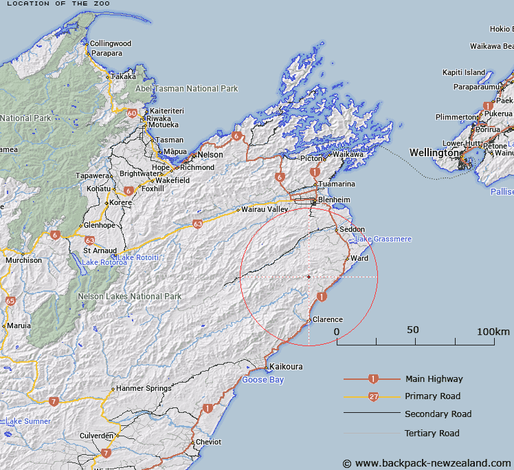
Map showing location of The Zoo


LINZ description: Headwaters area of the Nidd Stream. Blocks VII and VIII Whernside Survey District.
Latitude: -41.921618
Longitude: 173.923259
Northing: 5358514.3
Easting: 1676556.3
Land District: Marlborough
Feat Type: Stream


Scroll down to see a more detailed road map and below that a topographical map showing the location of The Zoo. The road map has been supplied by openstreetmap and the topographical map of The Zoo has been supplied by Land Information New Zealand (LINZ).

Yes you can use the top static map for you school/university project or personal website with a link back. Contact me for any commercial use.

The Zoo Map New Zealand


New Zealand places in our database
[ A ] [ B ] [ C ] [ D ] [ E ] [ F ] [ G ] [ H ] [ I ] [ J ] [ K ] [ L ] [ M ] [ N ] [ O ] [ P ] [ Q ] [ R ] [ S ] [ T ] [ U ] [ V ] [ W ] [ X ] [ Y ] [ Z ]


Closest 20 Streams to The Zoo

The Zoo ( 0km )   Nidd Stream ( 2.62km )   Whitewash Stream ( 2.73km )   Burnt Stream ( 3.33km )   Cover Stream ( 3.36km )   Paton Stream ( 3.42km )   Brian Boru Stream ( 3.62km )   Box Stream ( 4.46km )   Horse Stream ( 4.62km )   Pikes Creek ( 4.69km )   Wharf Stream ( 5.12km )   Isolation Creek ( 5.95km )   Waima River ( 6.65km )   Ure River ( 6.65km )   Swale Stream ( 6.83km )   Headache Stream ( 7.28km )   Ben More Stream ( 7.38km )   Glencoe Stream ( 7.61km )   Ouse Stream ( 7.66km )   Floodgate Stream ( 7.97km )   Black Angel Stream ( 8.18km )   Boundary Stream ( 8.37km )   Ned Stream ( 8.98km )   Woodside Creek ( 9.02km )   Cutterig Stream ( 9.34km )   Lower Swale Stream ( 9.41km )   Blue Mountain Stream ( 9.85km )   Kekerangu River ( 9.94km )   Kekerengu River ( 9.94km )   Brown Stream ( 10km )   Little Colonel Stream ( 10.43km )   Valhalla Creek ( 10.52km )   Snoutfield ( 10.52km )   Briny Brook ( 10.52km )   Medway River ( 11.15km )   Dunsandel Creek ( 11.28km )   Boundary Stream ( 11.6km )   Mead Stream ( 11.73km )   Tirohanga Stream ( 11.79km )   Bullock Head Stream ( 12.07km )