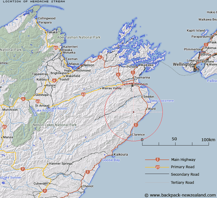
Map showing location of Headache Stream


LINZ description: Stream flowing south-east from the Blue Mountain Range to join the Waima River
Latitude: -41.865175
Longitude: 173.967899
Northing: 5364740.2
Easting: 1680328.5
Land District: Marlborough
Feat Type: Stream


Scroll down to see a more detailed road map and below that a topographical map showing the location of Headache Stream. The road map has been supplied by openstreetmap and the topographical map of Headache Stream has been supplied by Land Information New Zealand (LINZ).

Yes you can use the top static map for you school/university project or personal website with a link back. Contact me for any commercial use.

Headache Stream Map New Zealand


New Zealand places in our database
[ A ] [ B ] [ C ] [ D ] [ E ] [ F ] [ G ] [ H ] [ I ] [ J ] [ K ] [ L ] [ M ] [ N ] [ O ] [ P ] [ Q ] [ R ] [ S ] [ T ] [ U ] [ V ] [ W ] [ X ] [ Y ] [ Z ]


Closest 20 Streams to Headache Stream

Black Angel Stream ( 1.1km )   Ure River ( 2.41km )   Waima River ( 2.41km )   Blue Mountain Stream ( 2.64km )   Isolation Creek ( 3.35km )   Box Stream ( 3.78km )   Brian Boru Stream ( 4.08km )   Dunsandel Creek ( 5.02km )   Whitewash Stream ( 6.17km )   Horse Stream ( 6.28km )   The Zoo ( 7.28km )   Little Colonel Stream ( 7.3km )   Butchers Creek ( 7.41km )   Woodside Creek ( 7.51km )   Elsies Creek ( 8.79km )   Boundary Stream ( 9.17km )   Paton Stream ( 9.33km )   Reids Creek ( 9.57km )   Nidd Stream ( 9.64km )   Flaxbourne River ( 10.09km )   Colonel Gully Stream ( 10.14km )   Ben More Stream ( 10.26km )   Cover Stream ( 10.54km )   Burnt Stream ( 10.6km )   Brown Stream ( 10.65km )   Swale Stream ( 11.08km )   Needles Creek ( 11.53km )   Flags Creek ( 11.58km )   Division Creek ( 11.6km )   Pikes Creek ( 11.96km )   Wharf Stream ( 12.33km )   Floodgate Stream ( 12.35km )   Tachalls Creek ( 12.47km )   Tatchell Creek ( 12.47km )   Richmond Brook ( 12.63km )   Glencoe Stream ( 12.72km )   Mirza Creek ( 13.16km )   Tirohanga Stream ( 13.18km )   Beaumont Creek ( 13.73km )   Lovells Creek ( 13.79km )