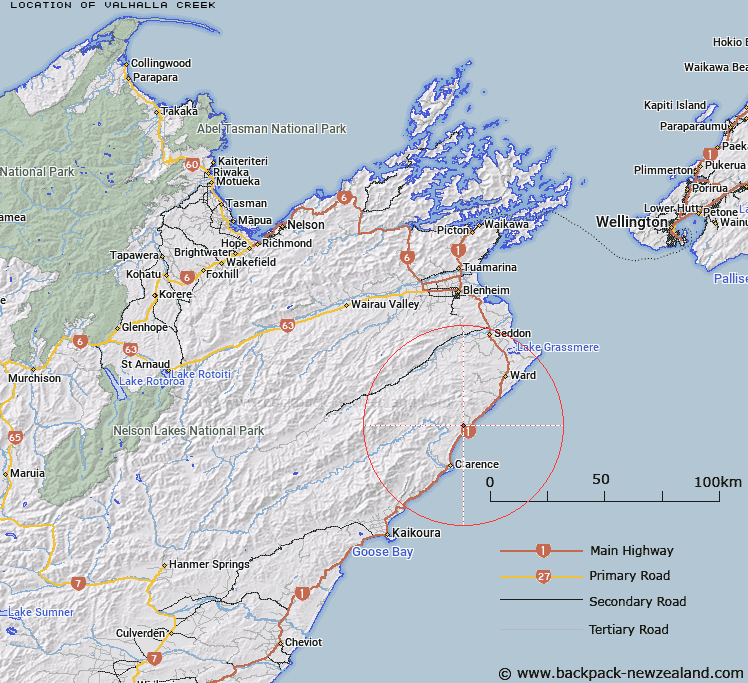
Map showing location of Valhalla Creek


LINZ description: Rises in Lady Range and flows easterly into sea.
Latitude: -42.007117
Longitude: 173.977734
Northing: 5348971.2
Easting: 1680965
Land District: Marlborough
Feat Type: Stream


Scroll down to see a more detailed road map and below that a topographical map showing the location of Valhalla Creek. The road map has been supplied by openstreetmap and the topographical map of Valhalla Creek has been supplied by Land Information New Zealand (LINZ).

Yes you can use the top static map for you school/university project or personal website with a link back. Contact me for any commercial use.

Valhalla Creek Map New Zealand


New Zealand places in our database
[ A ] [ B ] [ C ] [ D ] [ E ] [ F ] [ G ] [ H ] [ I ] [ J ] [ K ] [ L ] [ M ] [ N ] [ O ] [ P ] [ Q ] [ R ] [ S ] [ T ] [ U ] [ V ] [ W ] [ X ] [ Y ] [ Z ]


Closest 20 Streams to Valhalla Creek

Kekerangu River ( 2.54km )   Kekerengu River ( 2.54km )   Glencoe Stream ( 3.1km )   Boundary Stream ( 3.56km )   Floodgate Stream ( 3.62km )   Deadman Stream ( 4.67km )   Ben More Stream ( 6.21km )   Cutterig Stream ( 6.69km )   Paton Stream ( 7.15km )   Woodbank Stream ( 7.25km )   Tirohanga Stream ( 7.77km )   Pikes Creek ( 8.41km )   Burnt Stream ( 8.75km )   Ned Stream ( 9.79km )   Wharf Stream ( 9.92km )   Cover Stream ( 10.1km )   Washdyke Stream ( 10.26km )   Big Stream ( 10.39km )   The Zoo ( 10.52km )   Nidd Stream ( 10.65km )   Ouse Stream ( 10.87km )   Woodside Creek ( 11.35km )   Kawauiti Stream ( 11.88km )   Brian Boru Stream ( 11.93km )   Isolation Creek ( 12.71km )   Flags Creek ( 13.16km )   Whitewash Stream ( 13.25km )   Kawaunui Stream ( 13.34km )   Gibson Stream ( 13.41km )   Ure River ( 13.81km )   Waima River ( 13.81km )   Camp Stream ( 13.85km )   Mead Stream ( 14.19km )   Priams Stream ( 14.35km )   Box Stream ( 14.55km )   Rika Stream ( 15.01km )   Horse Stream ( 15.13km )   Limburn Stream ( 15.59km )   Headache Stream ( 15.8km )   McLean Stream ( 15.91km )