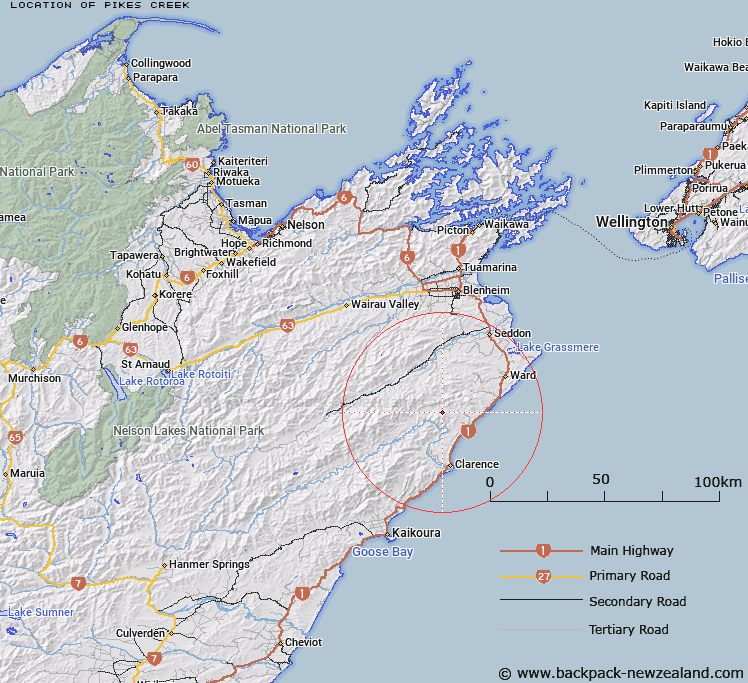
Map showing location of Pikes Creek


LINZ description: South branch of Wharf Stream, rising from the Sawtooth Range, 1km East of The Pikes. Blocks VII and VIII, Whernside Survey District.
Latitude: -41.959599
Longitude: 173.898593
Northing: 5354319
Easting: 1674466.7
Land District: Marlborough
Feat Type: Stream


Scroll down to see a more detailed road map and below that a topographical map showing the location of Pikes Creek. The road map has been supplied by openstreetmap and the topographical map of Pikes Creek has been supplied by Land Information New Zealand (LINZ).

Yes you can use the top static map for you school/university project or personal website with a link back. Contact me for any commercial use.

Pikes Creek Map New Zealand


New Zealand places in our database
[ A ] [ B ] [ C ] [ D ] [ E ] [ F ] [ G ] [ H ] [ I ] [ J ] [ K ] [ L ] [ M ] [ N ] [ O ] [ P ] [ Q ] [ R ] [ S ] [ T ] [ U ] [ V ] [ W ] [ X ] [ Y ] [ Z ]


Closest 20 Streams to Pikes Creek

Burnt Stream ( 1.36km )   Wharf Stream ( 1.59km )   Cover Stream ( 2.04km )   Nidd Stream ( 2.94km )   Ouse Stream ( 3.65km )   Paton Stream ( 4.12km )   Ned Stream ( 4.4km )   The Zoo ( 4.69km )   Cutterig Stream ( 4.87km )   Boundary Stream ( 5.17km )   Glencoe Stream ( 6.48km )   Whitewash Stream ( 6.75km )   Floodgate Stream ( 7.53km )   Swale Stream ( 7.68km )   Mead Stream ( 7.9km )   Brian Boru Stream ( 8.12km )   Horse Stream ( 8.29km )   Valhalla Creek ( 8.41km )   Snoutfield ( 8.41km )   Briny Brook ( 8.41km )   Ben More Stream ( 8.5km )   Lower Swale Stream ( 8.76km )   Box Stream ( 9km )   Kekerangu River ( 9.02km )   Kekerengu River ( 9.02km )   Limburn Stream ( 9.46km )   Big Stream ( 9.82km )   Gibson Stream ( 9.99km )   Deadman Stream ( 10.24km )   Isolation Creek ( 10.24km )   Waima River ( 11.1km )   Ure River ( 11.1km )   Medway River ( 11.38km )   Headache Stream ( 11.96km )   Woodside Creek ( 12.15km )   Brown Stream ( 12.44km )   Tirohanga Stream ( 12.79km )   Black Angel Stream ( 12.87km )   Woodbank Stream ( 12.88km )   Bullock Head Stream ( 13.16km )