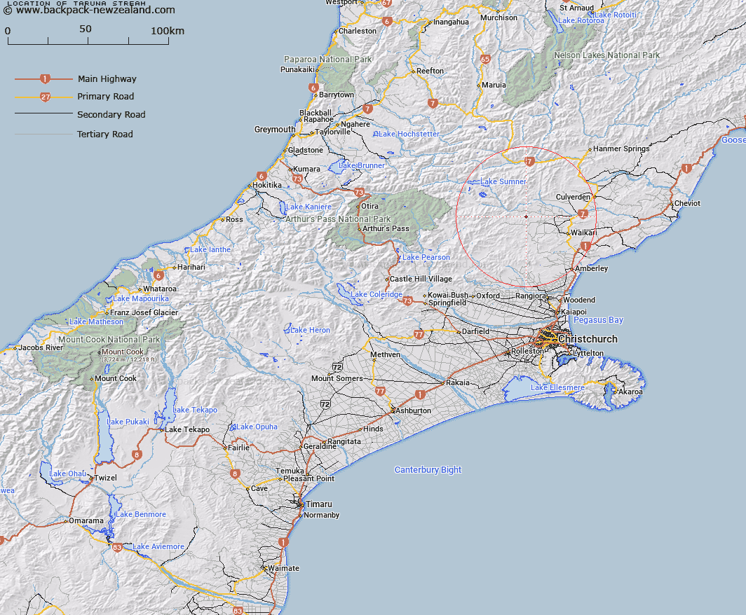
Map showing location of Taruna Stream


LINZ description: Right bank tributary of Waitohi River rising North-east of Trig. K (Geodetic Code A9DV), flowing northward and joining Waitohi River 1.3km South-west of Seven Hills Homestead. Block I, Waipara Survey District.
Latitude: -42.878229
Longitude: 172.478941
Northing: 5252575.9
Easting: 1557445.5
Land District: Canterbury
Feat Type: Stream


Scroll down to see a more detailed road map and below that a topographical map showing the location of Taruna Stream. The road map has been supplied by openstreetmap and the topographical map of Taruna Stream has been supplied by Land Information New Zealand (LINZ).

Yes you can use the top static map for you school/university project or personal website with a link back. Contact me for any commercial use.

Taruna Stream Map New Zealand


New Zealand places in our database
[ A ] [ B ] [ C ] [ D ] [ E ] [ F ] [ G ] [ H ] [ I ] [ J ] [ K ] [ L ] [ M ] [ N ] [ O ] [ P ] [ Q ] [ R ] [ S ] [ T ] [ U ] [ V ] [ W ] [ X ] [ Y ] [ Z ]


Closest 20 Streams to Taruna Stream

Kashmir Stream ( 3.1km )   Waitohi River ( 3.13km )   Jacks Stream ( 3.35km )   Stokes Stream ( 3.98km )   Melrose Stream ( 4.35km )   Dyfryn Stream ( 5.06km )   Waipara River North Branch ( 6.16km )   Spring Stream ( 6.21km )   Surveyors Stream ( 6.29km )   Mulligan Stream ( 6.33km )   Swampy Creek ( 6.7km )   Big Bush Stream ( 6.93km )   Hilton Stream ( 7.39km )   Waipapa River North Branch ( 7.61km )   Little Bush Stream ( 7.66km )   Washpen Stream ( 8.01km )   Cabin Stream ( 8.26km )   Tommys Stream ( 8.86km )   Pig Stream ( 9.6km )   Double End Stream ( 10.24km )   Dozy Stream ( 10.96km )   Woodchopper Stream ( 10.97km )   Matagouri Stream ( 11.01km )   Bridge Creek ( 11.03km )   Dampier Stream ( 11.22km )   Teardrop Stream ( 11.28km )   Virginia Stream ( 11.44km )   Manilla Stream ( 11.7km )   Swampy Stream ( 11.72km )   Devils Creek ( 11.95km )   Deadwood Stream ( 12.02km )   Horseshoe Stream ( 12.2km )   Dust Stream ( 12.26km )   Robyne Creek ( 12.29km )   Coal Creek ( 12.48km )   Leaseman Stream ( 12.9km )   Heathstock Stream ( 13.53km )   Rough Stream ( 13.74km )   Waipara River Middle Branch ( 13.92km )   Chinsurah Stream ( 14.49km )