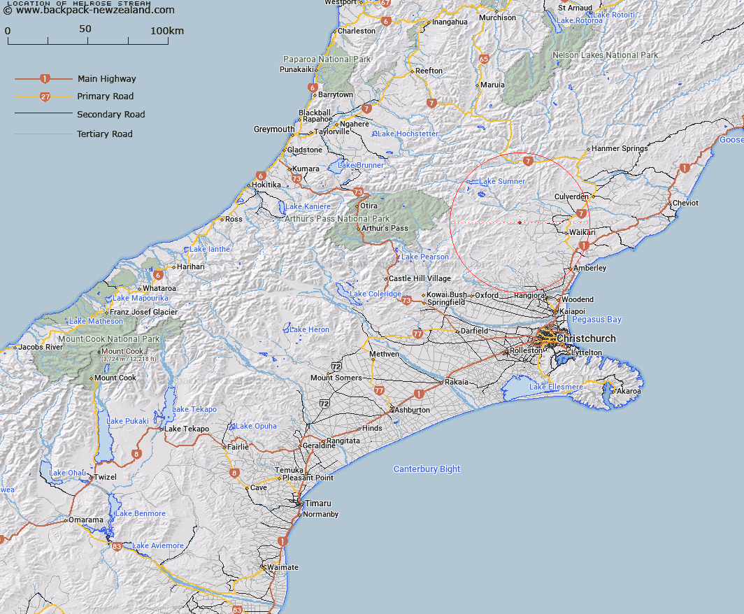
Map showing location of Melrose Stream


LINZ description: Left bank tributary of Waipara River North Branch rising 4km East of Mount Mason [Trig. Q (Geodetic Code 1147)], flowing southward and joining Waipara River North Branch 2km East of Melrose Homestead. Block VIII, Okuku Survey District.
Latitude: -42.913055
Longitude: 172.454621
Northing: 5248696
Easting: 1555484.4
Land District: Canterbury
Feat Type: Stream


Scroll down to see a more detailed road map and below that a topographical map showing the location of Melrose Stream. The road map has been supplied by openstreetmap and the topographical map of Melrose Stream has been supplied by Land Information New Zealand (LINZ).

Yes you can use the top static map for you school/university project or personal website with a link back. Contact me for any commercial use.

Melrose Stream Map New Zealand


New Zealand places in our database
[ A ] [ B ] [ C ] [ D ] [ E ] [ F ] [ G ] [ H ] [ I ] [ J ] [ K ] [ L ] [ M ] [ N ] [ O ] [ P ] [ Q ] [ R ] [ S ] [ T ] [ U ] [ V ] [ W ] [ X ] [ Y ] [ Z ]


Closest 20 Streams to Melrose Stream

Kashmir Stream ( 2.21km )   Swampy Creek ( 2.36km )   Waipapa River North Branch ( 3.29km )   Dyfryn Stream ( 4.09km )   Taruna Stream ( 4.35km )   Hilton Stream ( 4.44km )   Cabin Stream ( 4.56km )   Tommys Stream ( 4.74km )   Big Bush Stream ( 6.33km )   Waipara River North Branch ( 6.43km )   Little Bush Stream ( 6.6km )   Jacks Stream ( 7.31km )   Teardrop Stream ( 7.37km )   Waitohi River ( 7.39km )   Matagouri Stream ( 7.51km )   Manilla Stream ( 7.72km )   Surveyors Stream ( 7.76km )   Bridge Creek ( 7.87km )   Deadwood Stream ( 8.08km )   Stokes Stream ( 8.24km )   Leaseman Stream ( 8.63km )   Mulligan Stream ( 9.62km )   Virginia Stream ( 9.79km )   Heathstock Stream ( 10.15km )   Double End Stream ( 10.16km )   Waipara River Middle Branch ( 10.17km )   Chinsurah Stream ( 10.18km )   Washpen Stream ( 10.26km )   Spring Stream ( 10.27km )   Dust Stream ( 11.38km )   Woodchopper Stream ( 11.47km )   Horseshoe Stream ( 12.53km )   Hut Branch ( 12.59km )   Dozy Stream ( 12.66km )   Retreat Creek ( 12.71km )   Seaward River ( 12.86km )   Swampy Stream ( 12.9km )   Whistling Creek ( 13.32km )   Trumper Stream ( 13.56km )   Blue Mountain Stream ( 13.85km )