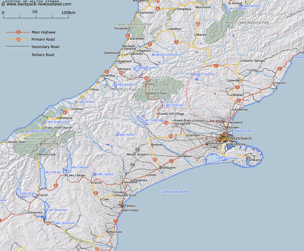
Map showing location of Hilton Stream


LINZ description: Left bank tributary of Tommys Stream rising 500m North of Mount Hilton, [Trig. T (Geodetic Code A9EB)], flowing westward then southward and joining Tommys Stream 1.7km South-west of Mount Hilton. Blocks V and IX, Waipara Survey District.
Latitude: -42.944354
Longitude: 172.488431
Northing: 5245237.6
Easting: 1558265.2
Land District: Canterbury
Feat Type: Stream


Scroll down to see a more detailed road map and below that a topographical map showing the location of Hilton Stream. The road map has been supplied by openstreetmap and the topographical map of Hilton Stream has been supplied by Land Information New Zealand (LINZ).

Yes you can use the top static map for you school/university project or personal website with a link back. Contact me for any commercial use.

Hilton Stream Map New Zealand


New Zealand places in our database
[ A ] [ B ] [ C ] [ D ] [ E ] [ F ] [ G ] [ H ] [ I ] [ J ] [ K ] [ L ] [ M ] [ N ] [ O ] [ P ] [ Q ] [ R ] [ S ] [ T ] [ U ] [ V ] [ W ] [ X ] [ Y ] [ Z ]


Closest 20 Streams to Hilton Stream

Cabin Stream ( 1.68km )   Dyfryn Stream ( 3km )   Tommys Stream ( 3.11km )   Matagouri Stream ( 3.68km )   Kashmir Stream ( 4.31km )   Swampy Creek ( 4.35km )   Teardrop Stream ( 4.36km )   Melrose Stream ( 4.44km )   Waipara River North Branch ( 4.79km )   Manilla Stream ( 4.85km )   Waipapa River North Branch ( 4.86km )   Heathstock Stream ( 6.14km )   Waipara River Middle Branch ( 6.67km )   Taruna Stream ( 7.39km )   Chinsurah Stream ( 8.58km )   Leaseman Stream ( 8.91km )   Washpen Stream ( 9.44km )   Waitohi River ( 9.66km )   Deadwood Stream ( 9.67km )   Swampy Stream ( 10.59km )   Big Bush Stream ( 10.7km )   Bridge Creek ( 10.73km )   Jacks Stream ( 10.73km )   Little Bush Stream ( 10.86km )   Blue Mountain Stream ( 11.06km )   Stokes Stream ( 11.26km )   Waipara River South Branch ( 11.49km )   Surveyors Stream ( 12.14km )   Mulligan Stream ( 13.53km )   Spring Stream ( 13.59km )   Virginia Stream ( 13.65km )   Weka Creek ( 14.23km )   Double End Stream ( 14.52km )   Retreat Creek ( 14.66km )   Nicholls Stream ( 14.77km )   Dust Stream ( 15.5km )   Rocky Stream ( 15.55km )   Whistling Creek ( 15.69km )   Boby Stream ( 15.72km )   Woodchopper Stream ( 15.88km )