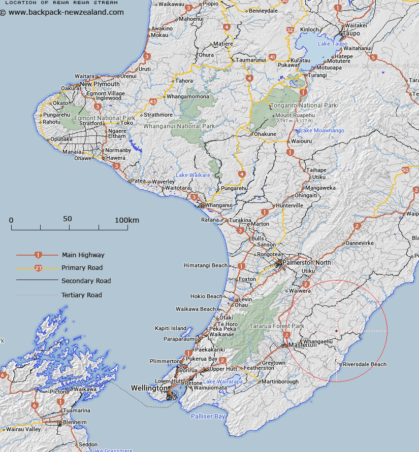
Map showing location of Rewa Rewa Stream


LINZ description: Right bank tributary of Whareama River rising South-east of Trig. Mount Cameron No 3 (Geodetic Code AP19), flowing South-eastward and joining Whareama River 900m South-east of Black Hill. Block XI Mangapakeha Survey District.
Latitude: -40.843737
Longitude: 176.041029
Northing: 5474137.5
Easting: 1856375.9
Land District: Wellington
Feat Type: Stream


Scroll down to see a more detailed road map and below that a topographical map showing the location of Rewa Rewa Stream. The road map has been supplied by openstreetmap and the topographical map of Rewa Rewa Stream has been supplied by Land Information New Zealand (LINZ).

Yes you can use the top static map for you school/university project or personal website with a link back. Contact me for any commercial use.

Rewa Rewa Stream Map New Zealand


New Zealand places in our database
[ A ] [ B ] [ C ] [ D ] [ E ] [ F ] [ G ] [ H ] [ I ] [ J ] [ K ] [ L ] [ M ] [ N ] [ O ] [ P ] [ Q ] [ R ] [ S ] [ T ] [ U ] [ V ] [ W ] [ X ] [ Y ] [ Z ]


Closest 20 Streams to Rewa Rewa Stream

Flag Creek ( 1.98km )   Centre Stream ( 3.86km )   South Branch Makirikiri Stream ( 4.24km )   Makirikiri Stream ( 4.31km )   Whakarora Stream ( 4.43km )   Vee Stream ( 4.81km )   Tinui River ( 4.86km )   Target Stream ( 5.09km )   North Branch Makirikiri Stream ( 5.27km )   Bute Stream ( 5.31km )   Balfour Stream ( 5.33km )   Whareama River ( 6.36km )   Marangai Stream ( 6.5km )   Te Wakaaraho Stream ( 7.63km )   Glencrieff Stream ( 8.32km )   Tauweru River ( 8.59km )   Mangapurupuru Stream ( 8.75km )   Bush Hill Stream ( 8.8km )   Annedale Stream ( 9.17km )   Motupaua Stream ( 9.18km )   Morepork Stream ( 9.31km )   Gentle Annie Stream ( 9.77km )   Bushgrove Stream ( 10.08km )   Waipu Stream ( 10.4km )   Pukeatua Stream ( 10.51km )   Ngakauau Stream ( 10.93km )   Bluegum Stream ( 10.97km )   Mangapakia Stream ( 11.05km )   Mangapakeha Stream ( 11.05km )   Wainuiomapu Stream ( 11.33km )   Anderson Stream ( 11.5km )   Ngaio Stream ( 11.82km )   Axehandle Stream ( 11.87km )   Whakataki River ( 12.08km )   Takiritini Stream ( 12.3km )   Otahome Stream ( 12.37km )   Ratanui Stream ( 12.51km )   Woody Gully Stream ( 12.6km )   Kaingaake Stream ( 13.77km )   Castlepoint Stream ( 14.12km )