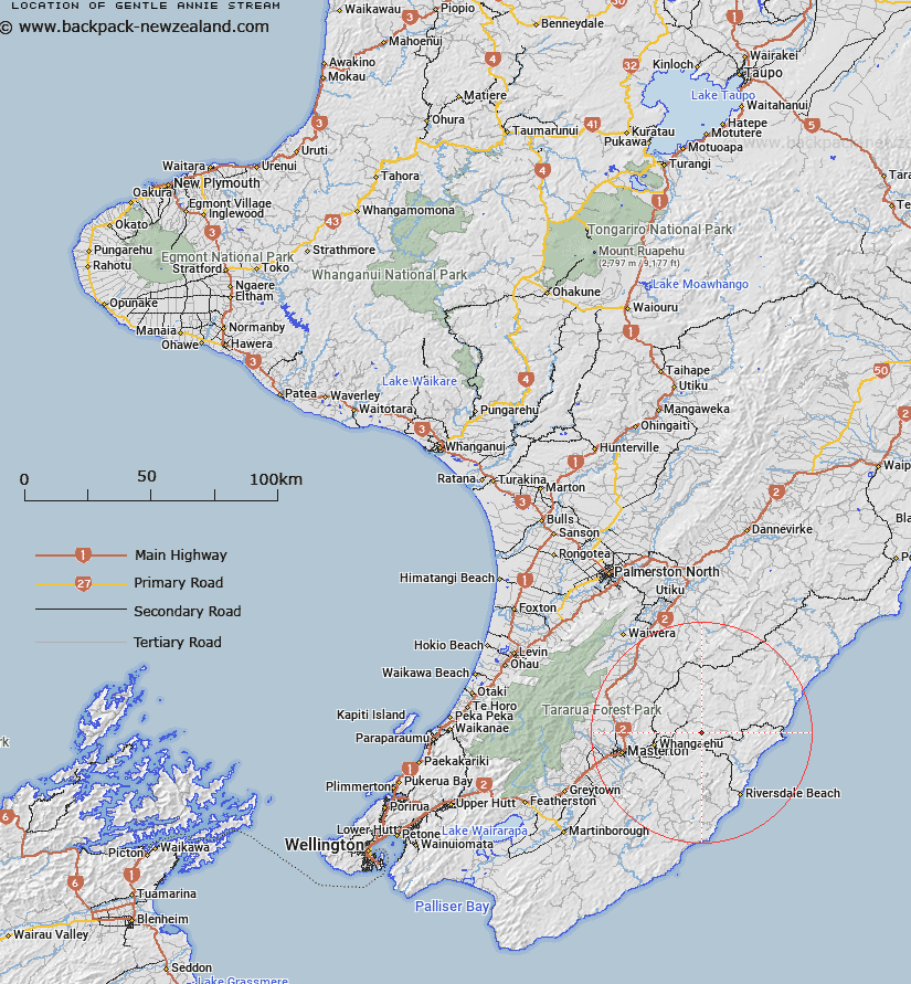
Map showing location of Gentle Annie Stream


LINZ description: Left bank tributary of Mangapakeha Stream rising 1.4km West of Trig. Bute No 2 (Geodetic Code AP10), flowing generally westward and joining Mangapakeha Stream 1km North North-west of Poronui Trig. (Geodetic Code AJT3). Blocks X and XIV Mangapakeha Survey District.
Latitude: -40.886633
Longitude: 175.939627
Northing: 5469667
Easting: 1847666
Land District: Wellington
Feat Type: Stream


Scroll down to see a more detailed road map and below that a topographical map showing the location of Gentle Annie Stream. The road map has been supplied by openstreetmap and the topographical map of Gentle Annie Stream has been supplied by Land Information New Zealand (LINZ).

Yes you can use the top static map for you school/university project or personal website with a link back. Contact me for any commercial use.

Gentle Annie Stream Map New Zealand


New Zealand places in our database
[ A ] [ B ] [ C ] [ D ] [ E ] [ F ] [ G ] [ H ] [ I ] [ J ] [ K ] [ L ] [ M ] [ N ] [ O ] [ P ] [ Q ] [ R ] [ S ] [ T ] [ U ] [ V ] [ W ] [ X ] [ Y ] [ Z ]


Closest 20 Streams to Gentle Annie Stream

Mangapakeha Stream ( 1.67km )   Mangapakia Stream ( 1.67km )   Anderson Stream ( 1.73km )   Glencrieff Stream ( 2.06km )   Ngaio Stream ( 2.07km )   Bushgrove Stream ( 2.27km )   Mangapurupuru Stream ( 3.99km )   Bute Stream ( 4.47km )   Marangai Stream ( 4.97km )   Balfour Stream ( 5.15km )   Whakarora Stream ( 5.65km )   Target Stream ( 6.79km )   Centre Stream ( 7.84km )   Flag Creek ( 8.06km )   Biscuit Stream ( 8.49km )   South Branch Makirikiri Stream ( 8.54km )   Blairlogie Stream ( 9.18km )   Rorokoko Stream ( 9.49km )   Ruatiki Stream ( 9.67km )   Rewa Rewa Stream ( 9.77km )   North Branch Makirikiri Stream ( 10.03km )   Makirikiri Stream ( 10.04km )   Waihonga Stream ( 10.14km )   Tauweru River ( 10.32km )   Kaumingi Stream ( 10.4km )   Teroterowhetu Stream ( 10.71km )   Vee Stream ( 11.4km )   Waipipi Stream ( 11.53km )   Stony Creek ( 11.86km )   Tinui River ( 11.91km )   Mangatopitopi Stream ( 11.92km )   Wainuiomapu Stream ( 12.05km )   Te Awaotenarahu Stream ( 12.38km )   Bush Hill Stream ( 13.23km )   Mangareia Stream ( 13.53km )   Waipawa Stream ( 14.42km )   Whareama River ( 14.59km )   Taumataria Stream ( 15.17km )   Wairorouaro Creek ( 15.65km )   Wainuiora River ( 15.91km )