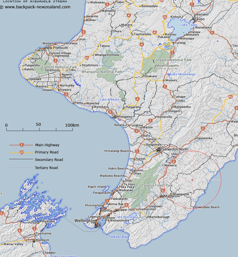
Map showing location of Axehandle Stream


LINZ description: Tributary of the upper Whareama River rising 600m South-west of Trig. No 5 D (Geodetic Code B64V), flowing generally southward and joining Whareama River 700m West South-west of Trig. Gunpowder (Geodetic Code AJLD). Block XV Puketoi and Block IV Mangapakeha Survey Districts.
Latitude: -40.737907
Longitude: 176.059312
Northing: 5485833.9
Easting: 1858327.7
Land District: Wellington
Feat Type: Stream


Scroll down to see a more detailed road map and below that a topographical map showing the location of Axehandle Stream. The road map has been supplied by openstreetmap and the topographical map of Axehandle Stream has been supplied by Land Information New Zealand (LINZ).

Yes you can use the top static map for you school/university project or personal website with a link back. Contact me for any commercial use.

Axehandle Stream Map New Zealand


New Zealand places in our database
[ A ] [ B ] [ C ] [ D ] [ E ] [ F ] [ G ] [ H ] [ I ] [ J ] [ K ] [ L ] [ M ] [ N ] [ O ] [ P ] [ Q ] [ R ] [ S ] [ T ] [ U ] [ V ] [ W ] [ X ] [ Y ] [ Z ]


Closest 20 Streams to Axehandle Stream

Bluegum Stream ( 1.23km )   Woody Gully Stream ( 1.25km )   Ratanui Stream ( 2.2km )   Annedale Stream ( 2.97km )   Waipu Stream ( 3.52km )   Morepork Stream ( 3.73km )   Whareama River ( 5.51km )   Wingate Stream ( 5.53km )   Waitawhiti Stream ( 7.62km )   Makorua Stream ( 7.87km )   Vee Stream ( 8.06km )   Takiritini Stream ( 9.24km )   North Branch Makirikiri Stream ( 9.34km )   Makirikiri Stream ( 9.39km )   Awatauira Stream ( 10.38km )   Tauweru River ( 10.42km )   South Branch Makirikiri Stream ( 10.86km )   Wainuiomapu Stream ( 11.17km )   Tiraumea Stream ( 11.4km )   Happy Creek ( 11.57km )   Pakowhai River ( 11.6km )   Centre Stream ( 11.63km )   Rewa Rewa Stream ( 11.87km )   Mangamaire Stream ( 11.95km )   Target Stream ( 12.57km )   Pakupanga Stream ( 12.64km )   Waihoki Stream ( 13.19km )   Motupaua Stream ( 13.48km )   Flag Creek ( 13.67km )   Waiorutoki Stream ( 13.76km )   Glenfalloch Stream ( 13.9km )   Smoky Gully Stream ( 13.96km )   Te Wakaaraho Stream ( 14km )   Pavitt Stream ( 14.13km )   Te Hoe Stream ( 14.57km )   Mascot Stream ( 14.75km )   Waiowaka Stream ( 14.83km )   Mataikona River ( 15.22km )   Makatote Stream ( 15.3km )   Tinui River ( 15.43km )