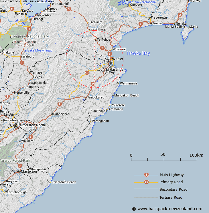
Map showing location of Puketautahi


LINZ description: At 353m height Geodetic code A4E5 east of the Tutaekuri River south west of Dartmoor
Latitude: -39.501019
Longitude: 176.666745
Northing: 5621200
Easting: 1915300
Land District: Hawke's Bay
Feat Type: Trig Station


Scroll down to see a more detailed road map and below that a topographical map showing the location of Puketautahi. The road map has been supplied by openstreetmap and the topographical map of Puketautahi has been supplied by Land Information New Zealand (LINZ).

Yes you can use the top static map for you school/university project or personal website with a link back. Contact me for any commercial use.

Puketautahi Map New Zealand


New Zealand places in our database
[ A ] [ B ] [ C ] [ D ] [ E ] [ F ] [ G ] [ H ] [ I ] [ J ] [ K ] [ L ] [ M ] [ N ] [ O ] [ P ] [ Q ] [ R ] [ S ] [ T ] [ U ] [ V ] [ W ] [ X ] [ Y ] [ Z ]


Closest 20 Trig Stations to Puketautahi

Salisbury ( 23.21km )   End ( 28.28km )   Kohinga ( 28.7km )   Kuripapango ( 31.97km )   Kaiarahi ( 33.48km )   Wakaateo ( 34.38km )   Waka Atea ( 34.38km )   Kahuranaki ( 37.13km )   Kauranaki ( 37.13km )   Parks Peak ( 38.78km )   Pohatuhaha ( 38.78km )   Parahakipaku ( 39.17km )   Remutupo ( 49.09km )   Waikamaka ( 49.09km )   Tataraakin ( 50.07km )   Patuwahine ( 50.32km )   Tauwheketewhango ( 55.46km )   Tawake Tohunga ( 55.46km )   Tawai-Tohunga ( 55.46km )   Tawheketewhango ( 55.46km )   Te Atuaoparapara ( 55.57km )   Wairakai ( 57.54km )   Paemutu ( 59.79km )   Mangaweka ( 60.97km )   Kawhatau ( 60.97km )   Ohuinga ( 61.16km )   Patuwahine ( 63.62km )   Pukakaramea ( 67.57km )   Pukaramea ( 67.57km )   Thunderbolt ( 70.36km )   Tuwatawata ( 88.82km )   Tuawatawata ( 88.82km )   Mapouriki ( 90.93km )   Maporiki ( 90.93km )   Motuoapa ( 94.65km )   Matanganui ( 98.02km )   Matanginui ( 98.02km )   Te Tahi ( 100.44km )   Ross ( 103.56km )   Mangamahu ( 105.47km )